drawing, print, paper, ink, engraving
#
drawing
#
dutch-golden-age
# print
#
landscape
#
paper
#
ink
#
geometric
#
engraving
Dimensions: height 252 mm, width 352 mm
Copyright: Rijks Museum: Open Domain
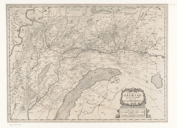
Nicolaes van Geelkercken made this map of the Roermond quarter, part of Gelderland, in the first half of the 17th century. Maps like this were not just geographical tools; they were deeply embedded in the political and social landscape of the Dutch Golden Age. Look at how the image creates meaning through visual codes. Consider the time in which it was made: a period marked by the Eighty Years' War, where the Dutch Republic was fighting for independence from Spanish rule. Cartography then was a strategic asset, delineating territories, trade routes, and military positions. This map reflects not only geographical knowledge but also political aspirations and territorial claims. It documents the region's towns, rivers, and landscapes and underscores the importance of such visual representations in shaping national identity. Delving into archives, correspondence, and period documents helps us understand the map’s creation and use. The meaning of art depends so much on its social and institutional context!
Comments
No comments
Be the first to comment and join the conversation on the ultimate creative platform.
More like this