drawing, print, ink, pen, engraving
#
drawing
#
dutch-golden-age
# print
#
old engraving style
#
hand drawn type
#
landscape
#
ink
#
orientalism
#
ink and pen line
#
pen work
#
pen
#
academic-art
#
engraving
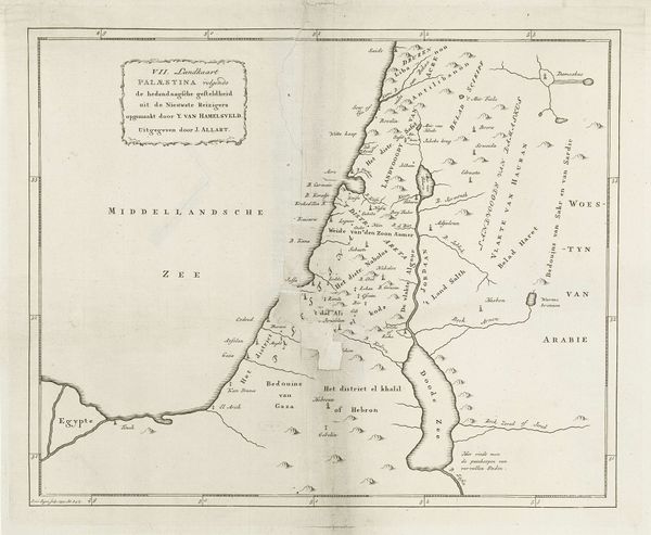
Dimensions: height 354 mm, width 449 mm
Copyright: Rijks Museum: Open Domain
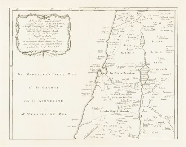
This detailed map of southern Palestine was rendered by Jan van Jagen, a Dutch cartographer, in the 18th century. What appears to be a mere geographical document is, in fact, a symbolic landscape steeped in historical and religious meaning. Here, the division of land among the tribes of Israel is not just a political boundary, but a visualization of destiny and divine promise. Consider, for instance, how the ‘Stam Juda’ or the ‘Tribe of Judah’ occupies a significant portion. This placement echoes the prophesies that establish Judah as the lineage of kings. We see similar symbolic weight in maps from different eras. The act of mapping is never neutral; it’s an assertion of power, a laying claim to both physical and ideological space. This symbolic resonance continues to evolve, reflecting changing cultural values and geopolitical realities. Maps, like myths, are continually rewritten by history.
Comments
No comments
Be the first to comment and join the conversation on the ultimate creative platform.
More like this