drawing, print, paper, engraving
#
drawing
#
pen drawing
# print
#
landscape
#
paper
#
line
#
northern-renaissance
#
engraving
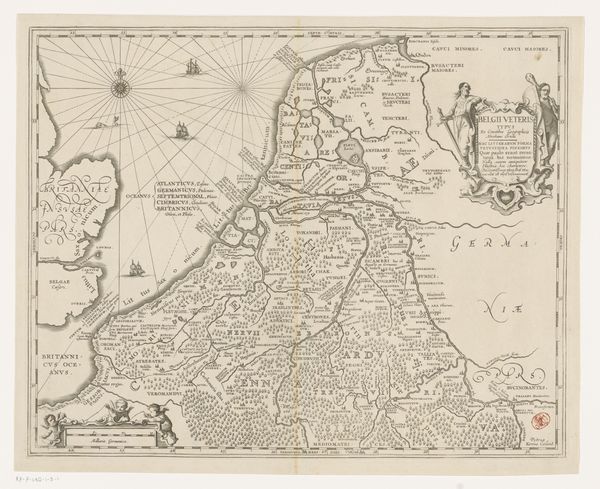
Dimensions: height 381 mm, width 498 mm
Copyright: Rijks Museum: Open Domain
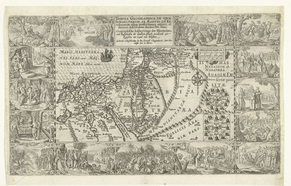
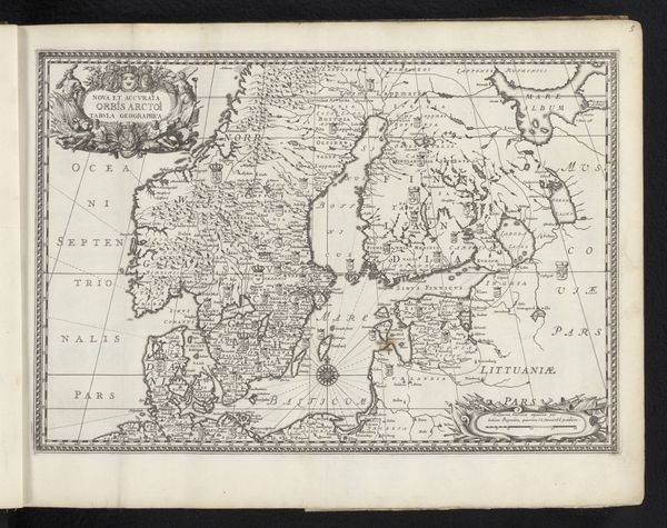
Curator: Right, let’s discuss Pieter van der Keere’s "Historische kaart van de Nederlanden" from 1617, a wonderfully detailed engraving on paper now held here at the Rijksmuseum. Editor: My first impression? Claustrophobic detail! It feels like every single tree and house is painstakingly accounted for. Makes me wonder about the obsession with control of landscape—but in a charming way. Curator: Indeed. Mapmaking during this period served many purposes beyond mere navigation. Consider that these weren't just geographic tools but also instruments of power. Van der Keere’s map provided a comprehensive view of the region to its rulers. Editor: Ah, right, power. But also maybe an early form of hyperrealism? I mean, look at those ships sailing on the left. They are quite beautiful and elaborate, even if the land looks somewhat compressed, bursting at its borders, it must reflect not just a geographical representation but a kind of boast too. “Look what we have!” Curator: Precisely. The ornate cartouches and figures framing the map are not accidental. They legitimize authority and imply the land’s historical significance. Notice also the use of Latin – projecting scholarship, wisdom. This isn't folk art. Editor: Folk art wants to be liberated by time while this piece craves status and validation through control. It’s like a real estate developer's fever dream. How fascinating that lines etched into paper could convey something as weighty as national identity, wouldn’t you say? Curator: Yes. But keep in mind that maps can construct identities and hierarchies and reflect a desired vision more than strict reality. This historical cartography serves to unite separate entities on paper while simultaneously signaling territory ripe for control. Editor: That shifts things again, doesn't it? Control versus just creating a sort of self-important beauty out of knowing what’s in your backyard. What you make clear for me is this isn't about orientation, is it? It's orientation in a totally different sense. Curator: Precisely. The map projects influence through knowledge, history, and even a visual claim to land ownership in this complicated historical context. Editor: Well, thinking about that, it’s almost impossible to just look at it innocently as a decorative or quaint antique print after you’ve pulled back its deeper social and historical context. But knowing makes appreciating it even more intense. Curator: For me too. Looking more deeply at a piece makes one want to always push the envelope with subsequent viewings.
Comments
No comments
Be the first to comment and join the conversation on the ultimate creative platform.
More like this