About this artwork
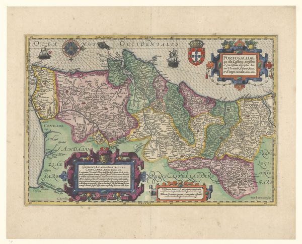
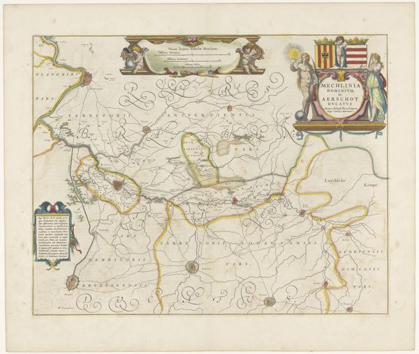
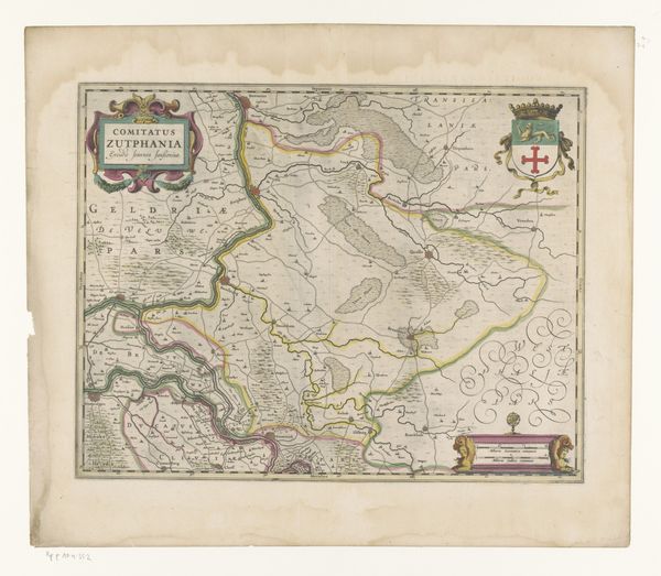
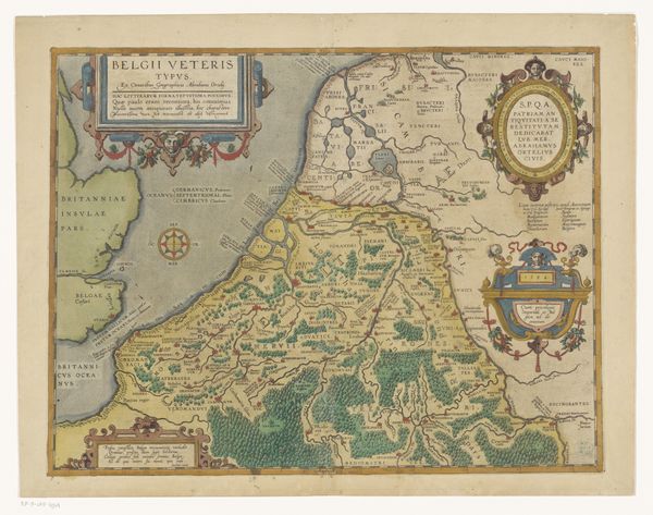
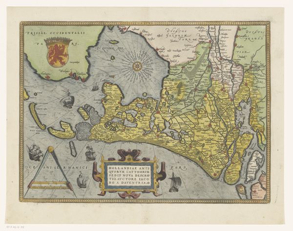
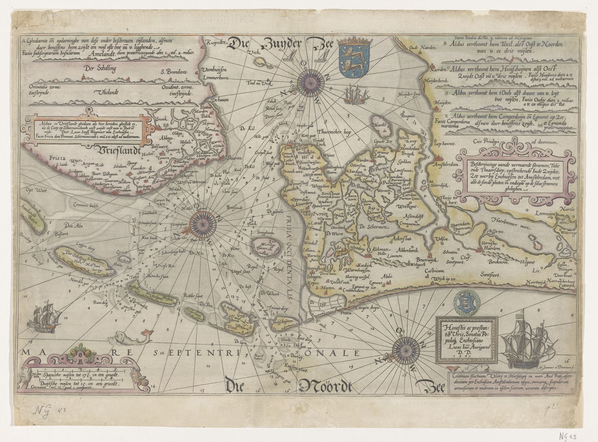
This is a map of the Vlie and Marsdiep, made by Joannes van (I) Doetechum in the Netherlands, sometime before 1605. At first glance, this seems to be purely representational, yet this map participates in, and even reinforces, the social order of its time. Maps like these were essential tools for the Dutch Republic, a rising mercantile power. They visualized trade routes, military strategy, and territorial claims. But more than that, the map projects power. It assumes mastery over the land and sea. Note the elaborate compass roses, and decorative cartouches. Consider the context: the Dutch Golden Age was built on maritime trade and colonial expansion. Maps like these were not just neutral representations of geography; they were instruments of empire. They gave the Dutch an edge in navigating and controlling the seas, furthering their economic and political dominance. To truly understand this map, we need to look at the broader history of cartography and colonialism. Who was commissioning these maps? How were they used? By understanding its context, we can appreciate how art is always embedded in the social and institutional realities of its time.
Paskaart van het Vlie en de Marsdiep 1583
Joannes van (I) Doetechum
1532 - 1605Location
RijksmuseumArtwork details
- Medium
- print, engraving
- Dimensions
- height 379 mm, width 516 mm
- Location
- Rijksmuseum
- Copyright
- Rijks Museum: Open Domain
Tags
dutch-golden-age
geometric
cityscape
engraving
Comments
No comments
About this artwork
This is a map of the Vlie and Marsdiep, made by Joannes van (I) Doetechum in the Netherlands, sometime before 1605. At first glance, this seems to be purely representational, yet this map participates in, and even reinforces, the social order of its time. Maps like these were essential tools for the Dutch Republic, a rising mercantile power. They visualized trade routes, military strategy, and territorial claims. But more than that, the map projects power. It assumes mastery over the land and sea. Note the elaborate compass roses, and decorative cartouches. Consider the context: the Dutch Golden Age was built on maritime trade and colonial expansion. Maps like these were not just neutral representations of geography; they were instruments of empire. They gave the Dutch an edge in navigating and controlling the seas, furthering their economic and political dominance. To truly understand this map, we need to look at the broader history of cartography and colonialism. Who was commissioning these maps? How were they used? By understanding its context, we can appreciate how art is always embedded in the social and institutional realities of its time.
Comments
No comments