#
comic strip sketch
#
old engraving style
#
etching
#
personal sketchbook
#
ink drawing experimentation
#
pen-ink sketch
#
pen work
#
sketchbook drawing
#
storyboard and sketchbook work
#
sketchbook art
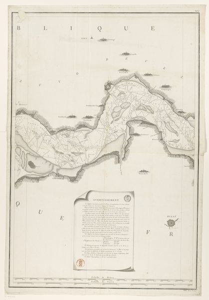
Dimensions: height 271 mm, width 217 mm
Copyright: Rijks Museum: Open Domain
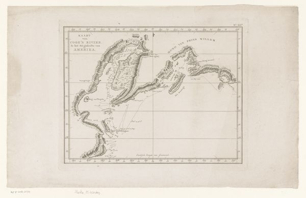
Here, we have Cornelis van Baarsel’s rendering of the Avatsja Bay in Kamchatka. Executed in the late 18th to early 19th century, this print offers a stark, linear portrayal of geographical space. The composition is dominated by finely etched lines that delineate land from water, with the bay's contours defined by a series of small, almost ornamental, island formations. Van Baarsel’s work embodies a cartographic aesthetic, where accuracy meets artistic interpretation. The map is not just a representation of space but also an assertion of control, a way of ordering and understanding a world that, for Europeans at the time, was largely unknown. The meticulous detailing, from the sparse vegetation indicated by tiny dots to the labeling of various points, suggests a desire to categorize and claim. The map, therefore, functions as a signifier of power, reflecting the broader European project of exploration and colonization. It invites us to consider how seemingly objective representations are always imbued with cultural and political ideologies.
Comments
No comments
Be the first to comment and join the conversation on the ultimate creative platform.
More like this