About this artwork
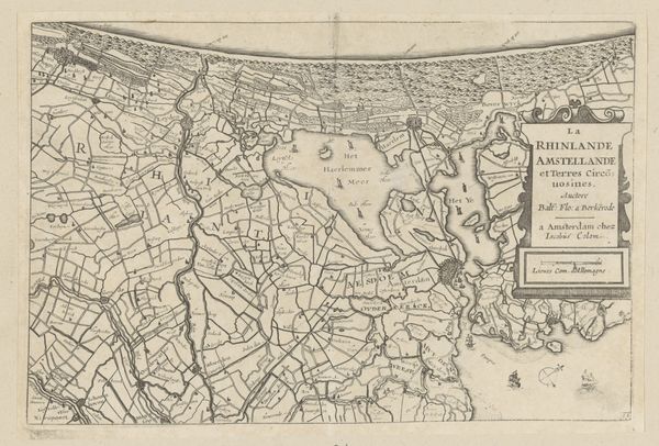
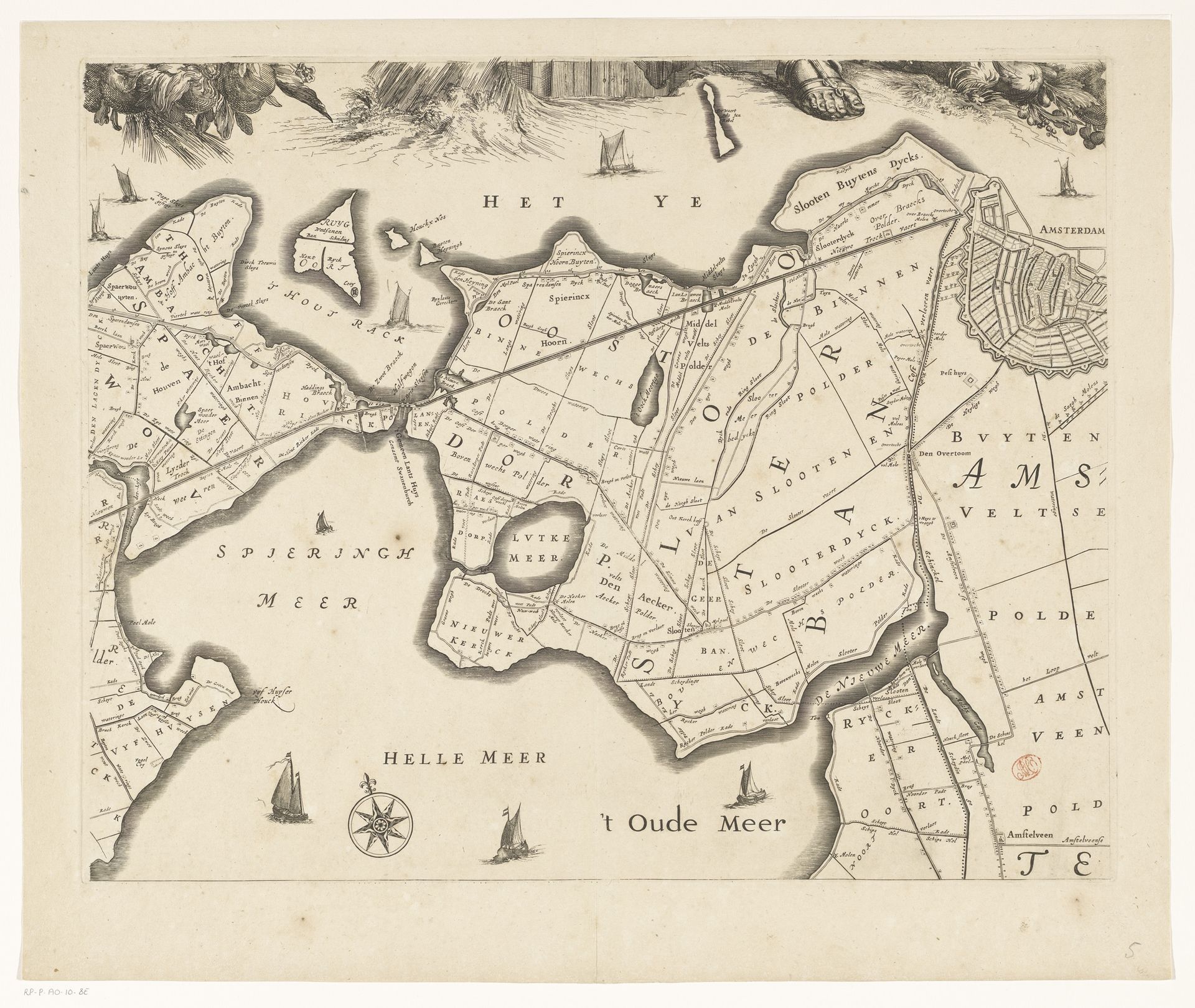
Cornelis Danckerts created this section of a map of Rijnland, near Amsterdam, in the mid-17th century using etching, a printmaking technique. A metal plate, likely copper, was coated with a waxy ground, and then the design was scratched into the surface, exposing the metal beneath. The plate was then submerged in acid, which bit into the exposed lines, creating grooves that would hold ink. The incised lines, with their crisp precision, allowed for detailed rendering of the region's waterways, polders, and settlements. Cartography like this involved a painstaking process of surveying, measuring, and drafting, reflecting the Dutch Republic's mastery of hydraulic engineering and land reclamation. It depended on both skilled labor and an increasingly sophisticated print industry that allowed for mass dissemination of information. Consider that for every print like this, many more were made. Maps like these weren't just geographic tools; they were instruments of power, visualizing control over land and resources, essential to the burgeoning Dutch mercantile empire. As such, the map transforms from a simple document to a political tool.
Kaart van het Hoogheemraadschap van Rijnland (vijfde deel) 1647 - 1687
Cornelis (I) Danckerts
1604 - 1656Location
RijksmuseumArtwork details
- Medium
- print, etching, engraving
- Dimensions
- height 457 mm, width 571 mm
- Location
- Rijksmuseum
- Copyright
- Rijks Museum: Open Domain
Tags
dutch-golden-age
etching
old engraving style
landscape
etching
geometric
cityscape
engraving
Comments
No comments
About this artwork
Cornelis Danckerts created this section of a map of Rijnland, near Amsterdam, in the mid-17th century using etching, a printmaking technique. A metal plate, likely copper, was coated with a waxy ground, and then the design was scratched into the surface, exposing the metal beneath. The plate was then submerged in acid, which bit into the exposed lines, creating grooves that would hold ink. The incised lines, with their crisp precision, allowed for detailed rendering of the region's waterways, polders, and settlements. Cartography like this involved a painstaking process of surveying, measuring, and drafting, reflecting the Dutch Republic's mastery of hydraulic engineering and land reclamation. It depended on both skilled labor and an increasingly sophisticated print industry that allowed for mass dissemination of information. Consider that for every print like this, many more were made. Maps like these weren't just geographic tools; they were instruments of power, visualizing control over land and resources, essential to the burgeoning Dutch mercantile empire. As such, the map transforms from a simple document to a political tool.
Comments
No comments