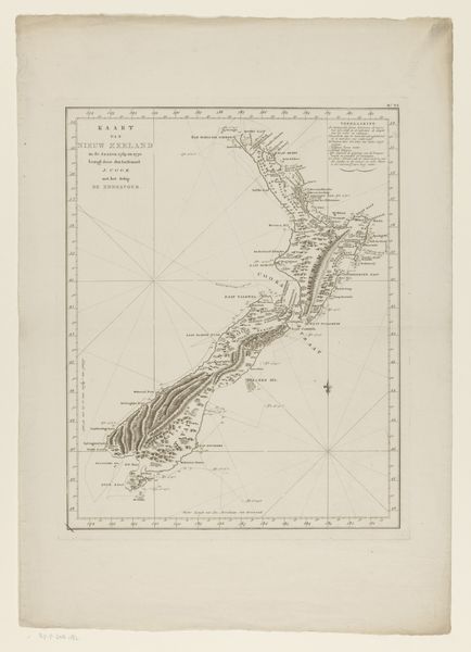
About this artwork
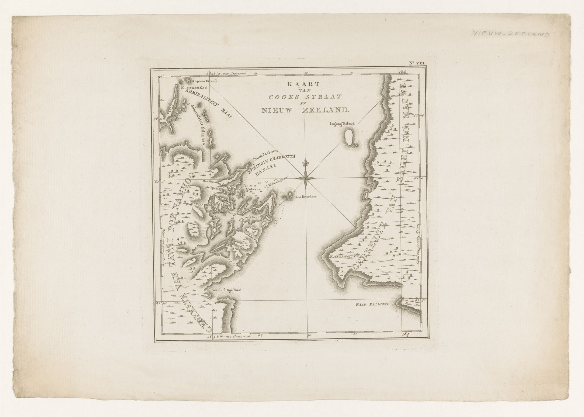
This map of the Cook Strait in New Zealand was made anonymously, using the technique of etching. With this intaglio printmaking method, an image is bitten into a metal plate with acid. The plate is then inked, and run through a press – transferring the design onto paper. The etcher’s skill is evident in the fine lines describing the coastline and topographical details. But it’s important to remember what such a map *did*. Cartography was essential to colonial projects, providing a means of visualizing and claiming territory. This map, like so many others, was a tool of empire. The labor involved in its production is easy to overlook, but it's central to understanding the map’s power and purpose. Though it's displayed as an aesthetic object, we should remember the work it performed in service of exploration, exploitation, and control. A stark reminder that maps are never neutral.
Artwork details
- Medium
- print, paper, engraving
- Dimensions
- height 284 mm, width 288 mm
- Copyright
- Rijks Museum: Open Domain
Tags
Comments
Share your thoughts
About this artwork
This map of the Cook Strait in New Zealand was made anonymously, using the technique of etching. With this intaglio printmaking method, an image is bitten into a metal plate with acid. The plate is then inked, and run through a press – transferring the design onto paper. The etcher’s skill is evident in the fine lines describing the coastline and topographical details. But it’s important to remember what such a map *did*. Cartography was essential to colonial projects, providing a means of visualizing and claiming territory. This map, like so many others, was a tool of empire. The labor involved in its production is easy to overlook, but it's central to understanding the map’s power and purpose. Though it's displayed as an aesthetic object, we should remember the work it performed in service of exploration, exploitation, and control. A stark reminder that maps are never neutral.
Comments
Share your thoughts