About this artwork
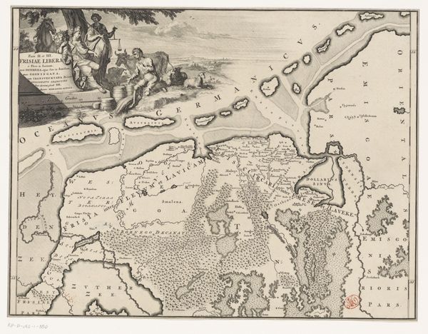
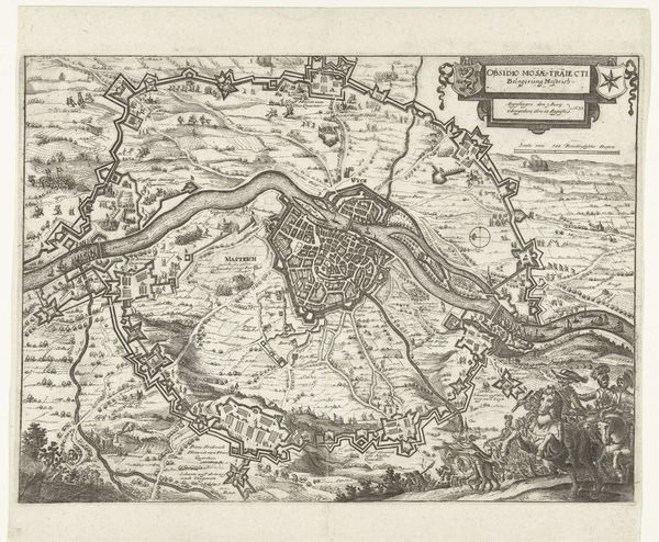
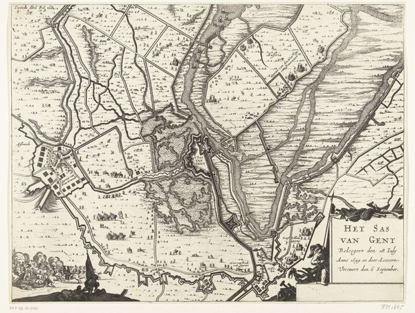
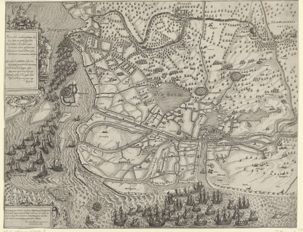
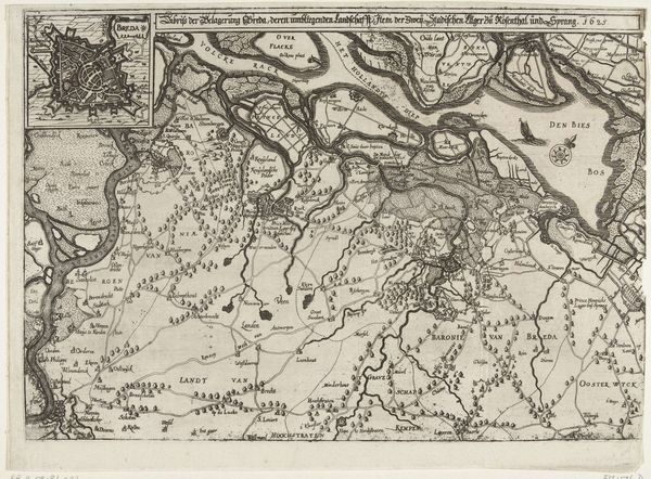
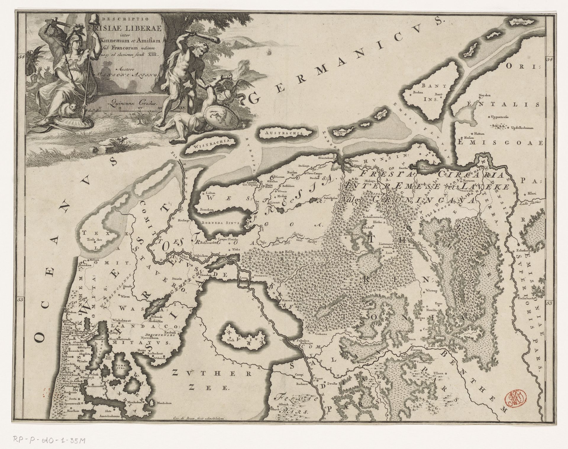
Curator: Let's take a closer look at this engraved map, titled "Historische kaart van Nederland met de gebieden van de Bataven en Friezen," which roughly translates to "Historical Map of the Netherlands with the areas of the Batavians and Frisians," created sometime between 1697 and 1725 by Gerrit de Broen. Editor: The fine detail is the first thing that jumps out. All of those tiny engraved lines make it almost tactile. It’s more than a map; it feels like an object intended for close study and reflection. Curator: Precisely. It speaks to a time when maps weren't just navigational tools but also objects of prestige and displays of power. Note the allegorical figures in the upper left; they help frame the map in the context of classical history, adding a layer of scholarly credibility. Editor: And look at the materials; you can imagine the artisan meticulously carving into the metal plate, carefully layering the image to be printed again and again on paper. What would the printmakers themselves think of how their labor is presented in the final object? Were they given due recognition? Curator: That’s an insightful point. Printmaking at the time was absolutely central to the dissemination of information, shaping perceptions of space and political territories. The engraving captures an idealized vision of the Netherlands' past. By linking the Dutch Republic to the Batavians and Frisians, it constructs a narrative of freedom and independence. Editor: Freedom and independence crafted, layer by layer, by the hands of anonymous engravers and printmakers! I see a kind of social tension in that – a historical claim presented on behalf of some made possible through the labor of others. And printed maps themselves participated in shaping territorial power. Curator: Definitely. The choice of what to include or exclude, the names assigned to certain areas, they’re not neutral acts. Maps reinforce existing power dynamics and assert claims of ownership and control. Editor: Looking at the final work again, its success depends so much on the expertise involved in creating and disseminating this map. Understanding this material background reframes its historical importance for me. Curator: Yes, this engraving highlights the interplay of art, politics, and historical narrative in shaping national identity during a period of significant change. The details speak volumes about how historical understanding was both produced and disseminated.
Historische kaart van Nederland met de gebieden van de Bataven en Friezen
1697 - 1725
Artwork details
- Medium
- print, engraving
- Dimensions
- height 317 mm, width 419 mm
- Copyright
- Rijks Museum: Open Domain
Tags
Comments
Share your thoughts
About this artwork
Curator: Let's take a closer look at this engraved map, titled "Historische kaart van Nederland met de gebieden van de Bataven en Friezen," which roughly translates to "Historical Map of the Netherlands with the areas of the Batavians and Frisians," created sometime between 1697 and 1725 by Gerrit de Broen. Editor: The fine detail is the first thing that jumps out. All of those tiny engraved lines make it almost tactile. It’s more than a map; it feels like an object intended for close study and reflection. Curator: Precisely. It speaks to a time when maps weren't just navigational tools but also objects of prestige and displays of power. Note the allegorical figures in the upper left; they help frame the map in the context of classical history, adding a layer of scholarly credibility. Editor: And look at the materials; you can imagine the artisan meticulously carving into the metal plate, carefully layering the image to be printed again and again on paper. What would the printmakers themselves think of how their labor is presented in the final object? Were they given due recognition? Curator: That’s an insightful point. Printmaking at the time was absolutely central to the dissemination of information, shaping perceptions of space and political territories. The engraving captures an idealized vision of the Netherlands' past. By linking the Dutch Republic to the Batavians and Frisians, it constructs a narrative of freedom and independence. Editor: Freedom and independence crafted, layer by layer, by the hands of anonymous engravers and printmakers! I see a kind of social tension in that – a historical claim presented on behalf of some made possible through the labor of others. And printed maps themselves participated in shaping territorial power. Curator: Definitely. The choice of what to include or exclude, the names assigned to certain areas, they’re not neutral acts. Maps reinforce existing power dynamics and assert claims of ownership and control. Editor: Looking at the final work again, its success depends so much on the expertise involved in creating and disseminating this map. Understanding this material background reframes its historical importance for me. Curator: Yes, this engraving highlights the interplay of art, politics, and historical narrative in shaping national identity during a period of significant change. The details speak volumes about how historical understanding was both produced and disseminated.
Comments
Share your thoughts