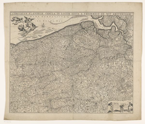
graphic-art, print, etching
#
graphic-art
#
baroque
# print
#
etching
#
landscape
#
etching
Dimensions: height 525 mm, width 610 mm
Copyright: Rijks Museum: Open Domain
This is an anonymous map of the Southern Netherlands, rendered with meticulous detail in ink on paper. At first glance, the density of information might overwhelm you, with its intricate network of lines, symbols, and text. The map’s structure operates on a complex semiotic system, where each element—be it a line representing a river or a symbol denoting a town—functions as a sign. Consider how the map invites a reading of power and knowledge. The act of mapping is inherently an act of claiming, defining, and controlling space. The precise lines and detailed inscriptions reflect an ambition to impose order on the territory it represents. Reflect on how this map challenges our understanding of space and representation. While it presents itself as an objective depiction of the Southern Netherlands, it is also a product of specific cultural codes and assumptions. The map is not just a mirror reflecting reality, but a lens shaping our perception of the world.
Comments
No comments
Be the first to comment and join the conversation on the ultimate creative platform.
More like this