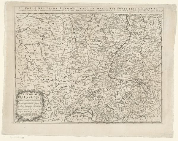
#
toned paper
#
light pencil work
#
pen sketch
#
pencil sketch
#
etching
#
ink drawing experimentation
#
pen-ink sketch
#
pen work
#
sketchbook art
#
watercolor
Dimensions: height 515 mm, width 570 mm
Copyright: Rijks Museum: Open Domain
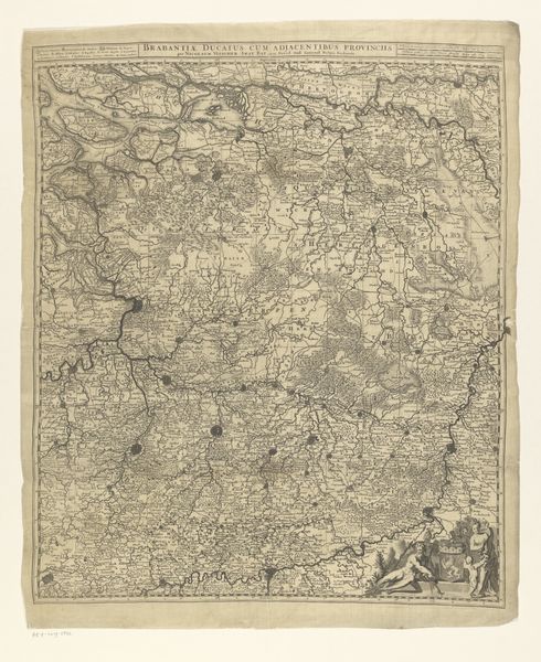
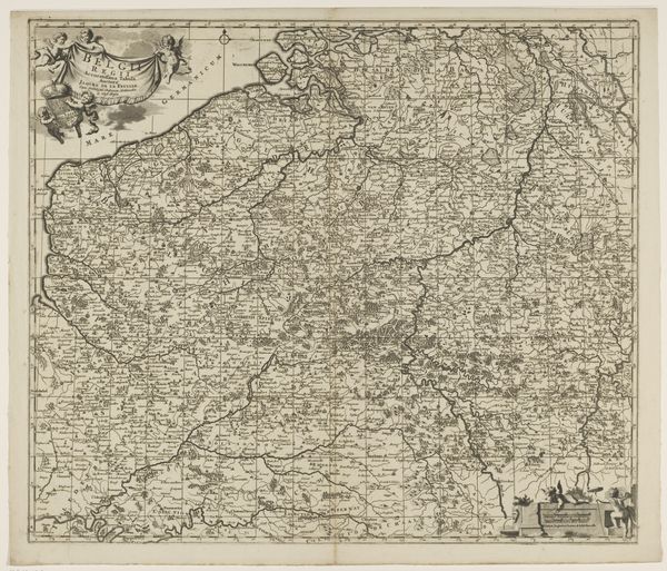
Curator: My initial impression is one of meticulous detail, a density of information presented with impressive clarity given the fineness of the linework. Editor: Indeed. What we are viewing here is a map of Brabant and Limburg, dating approximately from 1706 to 1712. It is the work of Jacobus Harrewijn. Notice the delicate etching. Curator: Yes, the intricacy of the etched lines creates a fascinating interplay of light and shadow, wouldn't you agree? The topographical features, rendered with such precision, almost give the landscape a sculptural quality. Editor: Precisely. Cartography during this era wasn’t merely about recording geography; it was a statement of power and knowledge. The level of detail suggests a strategic, perhaps even military, purpose. Think about the political landscape of the time – territorial disputes, shifting alliances... a detailed map like this would have been an invaluable asset. Curator: The stylized features are intriguing. Note how bodies of water aren't photorealistic, instead relying on conventional symbols—a conscious abstraction which highlights its inherent artifice. This pushes it beyond mere functionality. Editor: Absolutely. Maps were commodities as much as works of science. Commissioned perhaps by a noble, gifted between royal families... Who controlled the map, in a sense, controlled the land, or at least the *perception* of the land. Look at the elaborate crests and lettering: signals of prestige and authority. Curator: Consider also how the material contributes to its meaning. The slight discoloration and the texture of the paper contribute an organic warmth. The work creates a complex interplay with the rational, geometrically determined layout. Editor: One almost gets the impression of seeing not just a depiction of land, but an ideology literally laid out. The visual rhetoric speaks volumes about power, about claiming space both physically and intellectually. Curator: Viewing it with an eye towards aesthetic form can, at a risk of reading too much, reveal subtle inclinations of its maker... perhaps Harrewijn wasn't only recording the region but was making subtle commentary. Editor: Ultimately, such artworks serve as tangible links to a particular socio-political climate and its concerns. They showcase both scientific progress and underscore how artistic interpretation is intrinsically tied to notions of territory and governance.
Comments
No comments
Be the first to comment and join the conversation on the ultimate creative platform.
More like this