drawing, print, etching, ink
pen and ink
drawing
baroque
pen drawing
pen sketch
etching
old engraving style
landscape
etching
ink
geometric
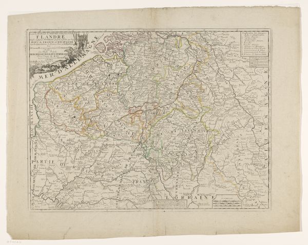
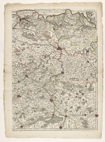
Dimensions: height 741 mm, width 1030 mm
Copyright: Rijks Museum: Open Domain
Curator: Before us, we have an etching dating back to 1729. This is the "Kaart van het graafschap Vlaanderen," or "Map of the County of Flanders," an anonymous work held here at the Rijksmuseum. What's your immediate impression? Editor: The level of detail is immediately striking! There’s something so intricate and methodical about its execution. But looking closer, the precision feels almost… cold. The whole landscape appears regimented and documented, not necessarily inviting. Curator: That's an interesting read. As a historical document, mapping wasn’t merely about objective representation. These maps shaped, reflected, and enforced power dynamics. The county of Flanders, strategically located, had been a site of contention and shifting identities for centuries. To delineate it like this suggests the ambition to control and administer it effectively. Editor: Absolutely. Maps *are* inherently political. I'm curious about the imagery chosen, though. Note the visual language in the upper left; the inclusion of heraldry in a flourished wreath seems to almost personify Flanders through symbolic representations of its governing body. Curator: That wreath connects to the established symbolic order of the era. But look beyond that established power. Consider the material realities of cartography itself; access to knowledge, skills in engraving, all situated within specific societal structures. What stories are absent from this representation of power? Who benefits, and who's left off the map, so to speak? Editor: The level of visual abstraction does flatten diverse experiences. The topography might reflect the physical land, but it homogenizes the people. I also find myself pondering how such imagery can instill cultural identity. Curator: Maps can be tools for legitimizing belonging, solidifying collective narratives of “us” and “them.” By omitting complexities of everyday life, of varied linguistic and cultural groups, of diverse experiences, they perpetuate a unified vision, or rather, a fiction of unity. Editor: It all loops back to control, doesn’t it? The visual language is carefully crafted to assert a particular claim and perspective. What an object this is – more than just geographical; it's political identity carved into a copper plate. Curator: Precisely, a poignant reminder that visual documents should always be approached as arguments, actively shaping our perceptions of reality.
Comments
No comments
Be the first to comment and join the conversation on the ultimate creative platform.