print, etching
#
baroque
# print
#
etching
#
landscape
#
etching
#
cityscape
Dimensions: height 430 mm, width 560 mm
Copyright: Rijks Museum: Open Domain
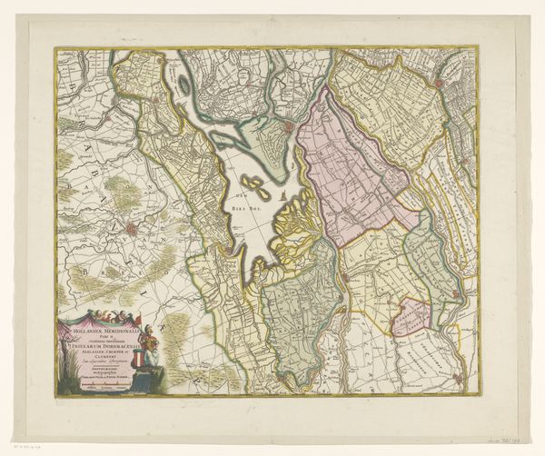
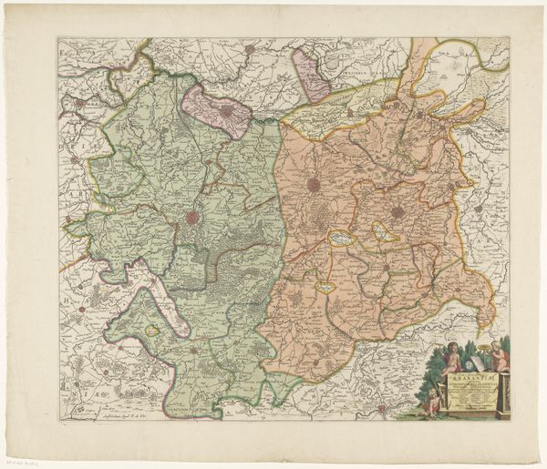
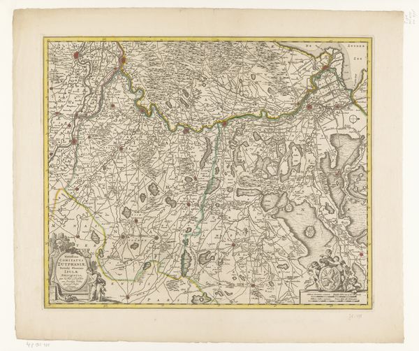
Curator: Here we have a 1709 etching by Abraham Allard entitled, "Kaart van Hengouwen met Bergen en omliggende steden", which translates to "Map of Hainaut with Bergen and surrounding cities." It depicts the region of Hainaut, now part of Belgium, in considerable detail. Editor: It's incredibly intricate! The formal qualities give the sense of organized chaos. The colours seem muted, giving the sense of something both ancient and strangely vital. The texture, though flat in the picture, implies incredible labour and process behind the carving. Curator: Indeed. This map offers insights into early 18th-century Dutch cartography and its reliance on etching. The precision used reflects not just the demands of the discipline, but of patronage as well. Patrons could wield symbolic influence through careful selection and control. This form of baroque visual rhetoric highlights societal and productive mechanisms that might escape those looking for artistic inspiration in something like painting alone. Editor: From a formal standpoint, observe the stark linearity used for roads versus the topographical differentiation shown by the etching itself. See how Allard manages to represent urban density with little clusters versus forests through similar repetitive shapes. It creates an all-over patterned feel which serves an immediate purpose as information, but then subliminally affects the aesthetic of the image too. Curator: Maps like these weren't just about geography; they were also instruments of power. Possession of the detailed knowledge that maps provided gave ruling powers very real capabilities. Look closely at how specific urban areas or geographic entities are delineated, reflecting strategic or proprietary interests. It wasn't just aesthetic choices, but also displays of geopolitical assertion in material form. Editor: Agreed! There's this incredible dialogue created between abstract sign and recognizable land that's also visible with any formal landscape painting. To me, Allard successfully captured not only a physical space, but also that elusive character of place we all intrinsically recognize and feel but that resists definition. Curator: Precisely. In analyzing the etcher's work and intention in a map like this, we better see how such works can affect public perception and facilitate control within and among the various burgeoning nations of this era. Editor: Absolutely, seeing the intentional aesthetic language applied, whether of utility or pure form, allows for insight and greater aesthetic fulfillment in itself!
Comments
No comments
Be the first to comment and join the conversation on the ultimate creative platform.
More like this