print, etching, engraving
baroque
etching
landscape
etching
engraving
Dimensions: height 447 mm, width 591 mm
Copyright: Rijks Museum: Open Domain
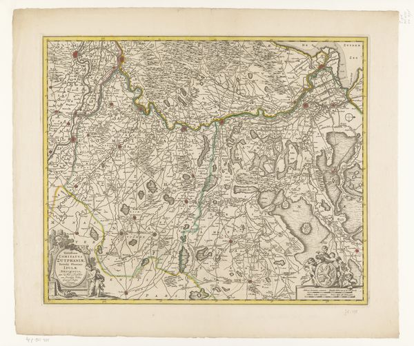
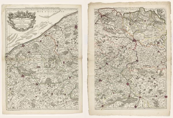
This map of Flanders, made by an anonymous artist, presents a detailed depiction of the region, its cities, and borders. The ornate cartouche, crowned by a fierce dragon, immediately captures our attention. Dragons, historically, have been symbols of chaos and guardians of treasure. Notice how the map delineates territories not just geographically but politically, reflecting the shifting power dynamics of the time. Such representations echo across centuries; consider the Roman practice of mapping conquered territories as acts of dominance, or even medieval tapestries depicting Eden, which blended geography with moral instruction. Here, the dragon atop the cartouche is not merely decorative, it is a complex symbol, suggesting both the allure and the dangers inherent in claiming and controlling land. This serpent-like figure, deeply rooted in our collective psyche, serves as a potent reminder of how we project our fears and desires onto the landscapes we inhabit. It is a cycle of representation and reinterpretation, ever twisting and evolving, yet perpetually resonant.
Comments
No comments
Be the first to comment and join the conversation on the ultimate creative platform.