print, pen, engraving
baroque
old engraving style
landscape
geometric
line
pen work
pen
engraving
Dimensions: height 393 mm, width 452 mm
Copyright: Rijks Museum: Open Domain
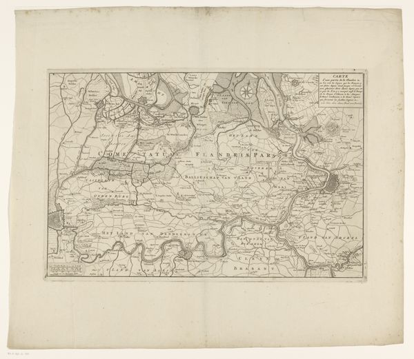
Curator: This is an early 17th-century map, specifically the “Kaart van het hertogdom Limburg,” created around 1611 or 1612. It’s rendered as a print, using pen and engraving techniques, made by an anonymous artist. Editor: My first impression? There's a captivating precision here. It is remarkably detailed; you can sense the weight each tiny etched line carries, conveying both information and a stark visual language. It almost feels like a coded manuscript, a landscape as data. Curator: Absolutely. The very act of mapping—the materials, the lines etched into the printing plate, the labor involved in replicating it—speaks volumes about early modern information production. Note the uniformity in depicting the natural resources as part of landscape art production at this period. This engraving makes me consider what’s highlighted – and what’s left out. Editor: What immediately pulls me in are the pictorial and textual emblems decorating it, small narrative vignettes. Like the man drawing the territory; its the symbol of skill as much as measurement, while ornate typography gives Limburg a specific cultural identity beyond pure geography. I also feel this Baroque treatment as cultural grandstanding, turning cartography into spectacle. Curator: Good point. I see a meticulous process, from the ground surveys informing the initial drawing to the mechanical reproduction of the engraving. Each stage introduces potential variations and the skill set involved becomes crucial for mass production, transforming it from handmade craftsmanship. How much control is the originator of the work in full control with a project that's meant for practical usage? Editor: I see continuity across time. Maps always function beyond the mere geographical record; there is an encoded meaning which goes beyond data points. Notice that the act of measurement and surveying can be an assertion of cultural control. The emblems become icons reinforcing Limburg’s presence within that particular era's understanding of space and its boundaries. Curator: Right. And that intersection is really where our interests converge: the interplay between materials, labor, the artistic style of time. By the nature of creating reproducible prints the cultural elite had a vehicle in mass production, while the act of creation was less glamorous by that point. Editor: Agreed. Reflecting on this "Kaart", its real value lies in the narrative depth encoded in symbols and cultural imprints. We perceive not only land but how land relates with that moment of self-understanding. Curator: Absolutely. This piece gives one so much to ponder as it provides insight into a network of material exchange. It makes us really examine how information was created and proliferated, and what sort of world the engravers themselves lived in while reproducing images for others.
Comments
No comments
Be the first to comment and join the conversation on the ultimate creative platform.