About this artwork
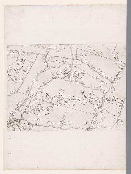
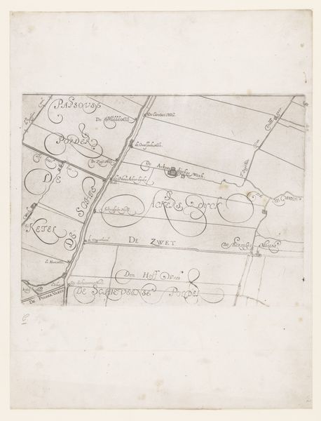
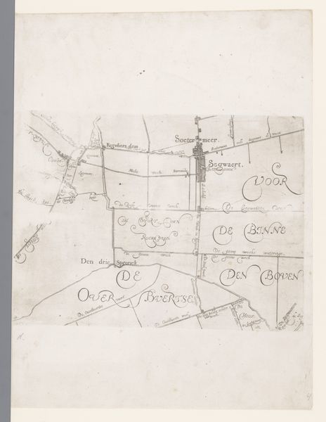
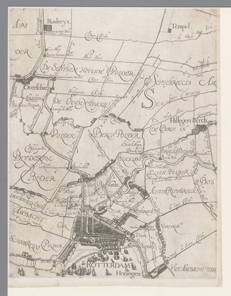
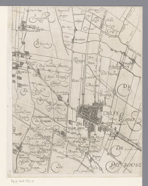
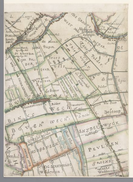
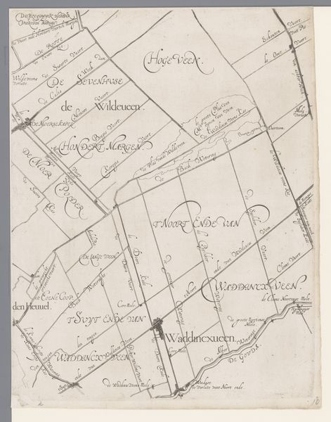
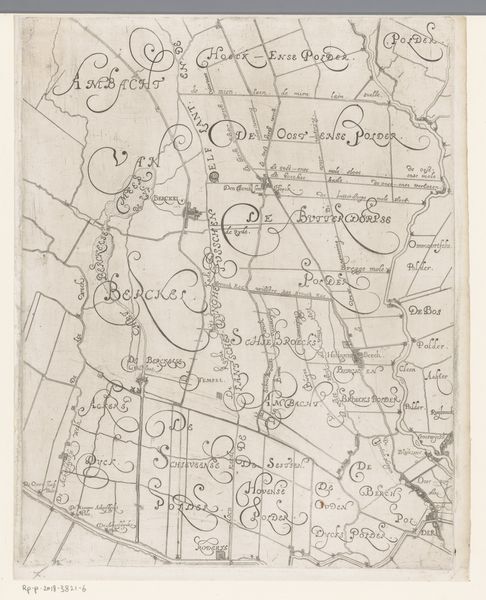
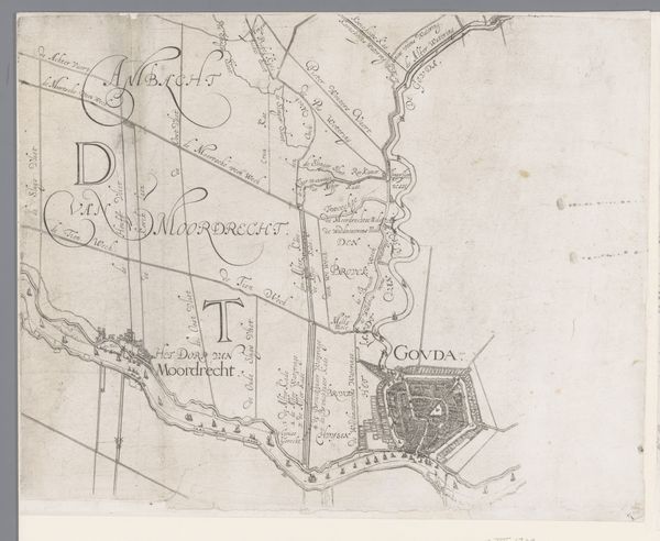
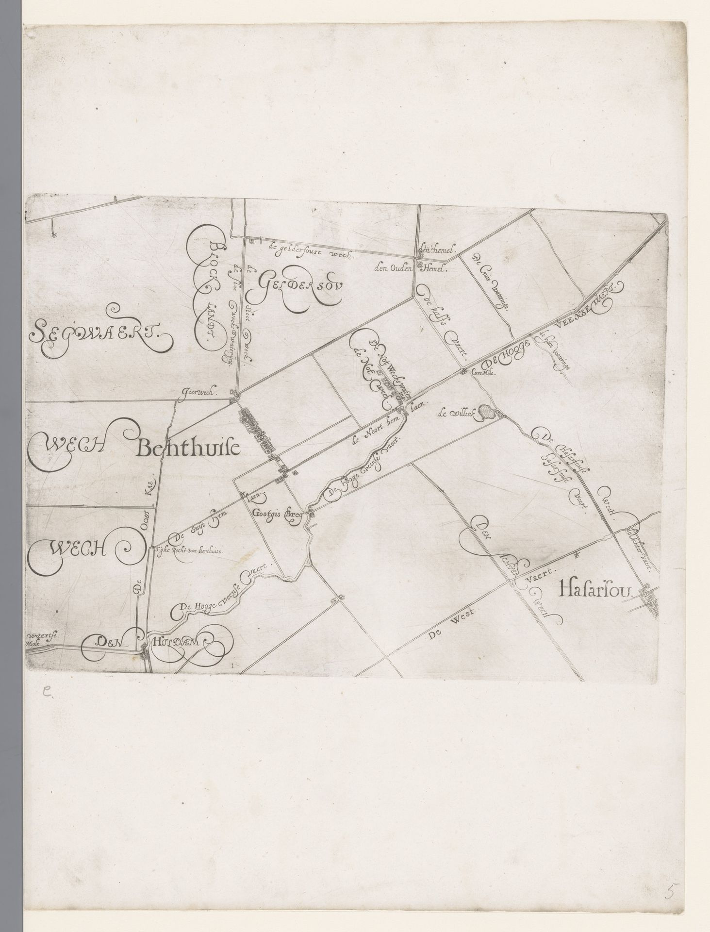
Floris Balthasarsz van Berckenrode created this map of the Hoogheemraadschap of Schieland, including Benthuizen and Hazerswoude. Though undated, it provides a window into the social and political life of the Netherlands during the Dutch Golden Age. The map isn’t just a geographical record; it's a document deeply intertwined with issues of land control, and, therefore, power. In the 17th century, land reclamation was a vital project in the Netherlands, and maps like these were instrumental in asserting ownership and control over newly ‘created’ territories. Think about how claiming land also meant claiming authority, and how this process affected the lives of ordinary people, the farmers, the laborers, the families whose lives were intimately connected to the land. The detailed rendering offers a sense of the period’s values and ambitions. It embodies the intersection of burgeoning capitalism, scientific exploration, and the complex social hierarchies that defined the time. The map is a testament to human intervention on the landscape. It invites us to consider the environmental implications of such grand designs, and the power dynamics involved in shaping our world.
Kaart van het Hoogheemraadschap van Schieland, met Benthuizen en Hazerswoude
1611 - 1635
Floris Balthasarsz van Berckenrode
1562 - 1616Location
RijksmuseumArtwork details
- Medium
- drawing, paper, ink
- Dimensions
- height 221 mm, width 298 mm
- Location
- Rijksmuseum
- Copyright
- Rijks Museum: Open Domain
Tags
Comments
Share your thoughts
About this artwork
Floris Balthasarsz van Berckenrode created this map of the Hoogheemraadschap of Schieland, including Benthuizen and Hazerswoude. Though undated, it provides a window into the social and political life of the Netherlands during the Dutch Golden Age. The map isn’t just a geographical record; it's a document deeply intertwined with issues of land control, and, therefore, power. In the 17th century, land reclamation was a vital project in the Netherlands, and maps like these were instrumental in asserting ownership and control over newly ‘created’ territories. Think about how claiming land also meant claiming authority, and how this process affected the lives of ordinary people, the farmers, the laborers, the families whose lives were intimately connected to the land. The detailed rendering offers a sense of the period’s values and ambitions. It embodies the intersection of burgeoning capitalism, scientific exploration, and the complex social hierarchies that defined the time. The map is a testament to human intervention on the landscape. It invites us to consider the environmental implications of such grand designs, and the power dynamics involved in shaping our world.
Comments
Share your thoughts