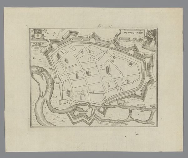
drawing, print, engraving
#
drawing
#
baroque
# print
#
geometric
#
cityscape
#
engraving
Dimensions: height 201 mm, width 275 mm
Copyright: Rijks Museum: Open Domain
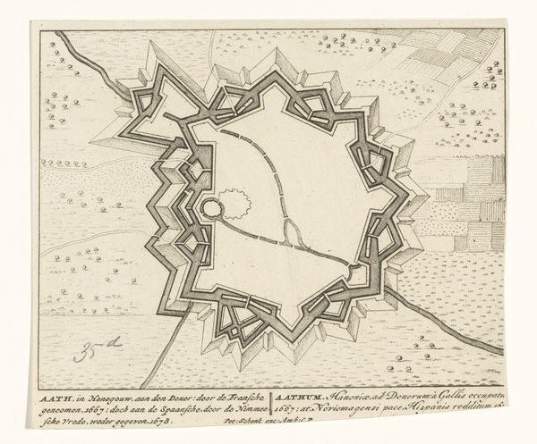
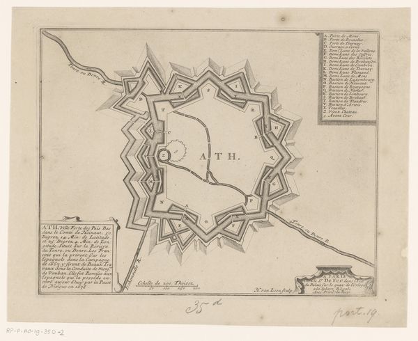
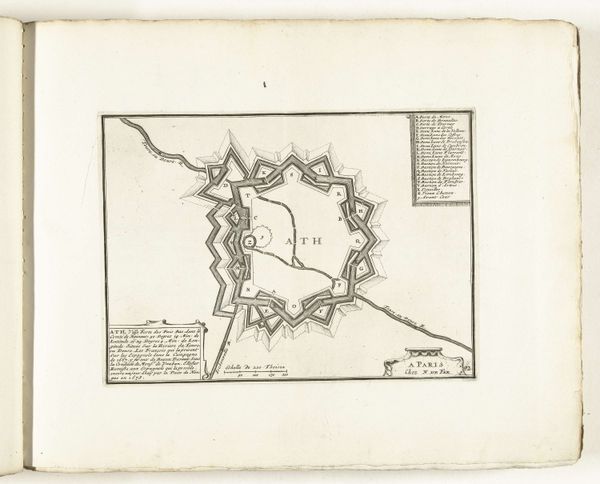
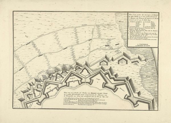
Curator: Here we have a striking print, "Plattegrond van de fortificaties rond de stad Ath," or "Map of the fortifications around the city of Ath," created between 1693 and 1697 by Harmanus van Loon. The precision of the engraving is remarkable, wouldn't you agree? Editor: Immediately I notice the radial symmetry and sharp angles of the fortified city. It feels more like an abstract geometric pattern than an organic cityscape. Stark, perhaps even unsettling, in its design. Curator: Precisely. The linear purity here underscores its functionality, speaking to the burgeoning military engineering of the Baroque era. The drawing exemplifies form following function. Editor: Which brings me to the labor involved. We often forget these maps were carefully constructed documents. Think of the manual skill required for engraving such fine detail! The creation itself embodies control and the strategic mindset of the time. Curator: A fair point. It embodies both precision and control, speaking to the order sought through geometrical design, reflecting power structures through the layout. See how the town is literally caged, a monument of calculated control and power. Editor: Right, control over the physical landscape translating into political control. Looking at the lines describing the earthwork and building, I start to think of how this process itself alters the land—mining ore for tools, reshaping topography for defense, mobilizing workers to erect walls. All incredibly resource-intensive. Curator: An excellent observation! The city becomes almost like a geometrical labyrinth; the very architecture speaks volumes. Notice the recurring shapes and motifs that dominate the structure. Editor: Well, considering van Loon as someone connected to this machine of resource extraction makes it far more complicated. Curator: Ultimately, we find a testament to order. In this diagram, the city's structure reflects rigid planning. Editor: Yes, seeing it now makes me reflect on the processes necessary to manifest such control. It’s an artifact imbued with evidence of that labour and ideology.
Comments
No comments
Be the first to comment and join the conversation on the ultimate creative platform.
More like this