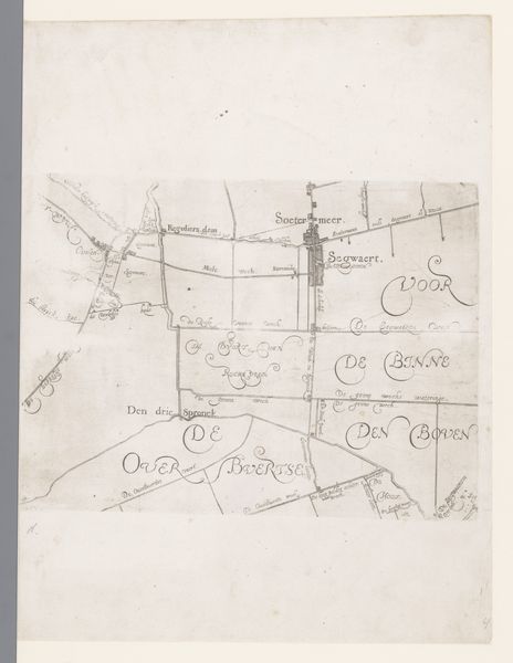
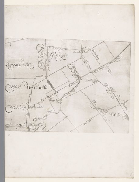
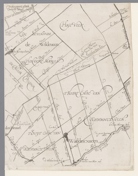
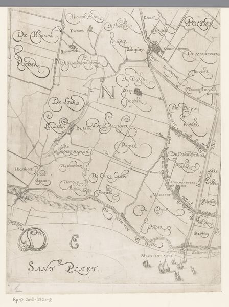
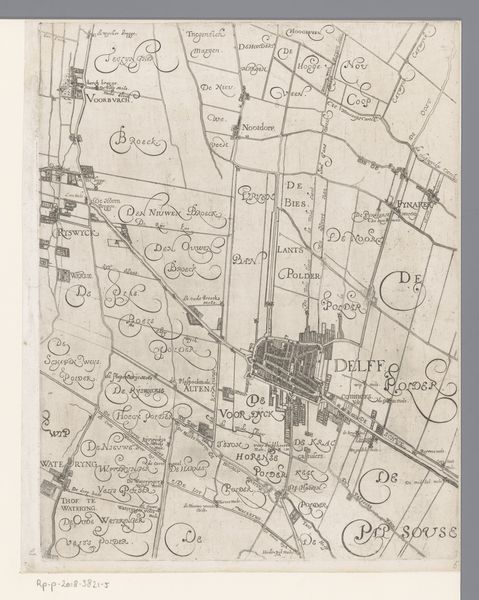
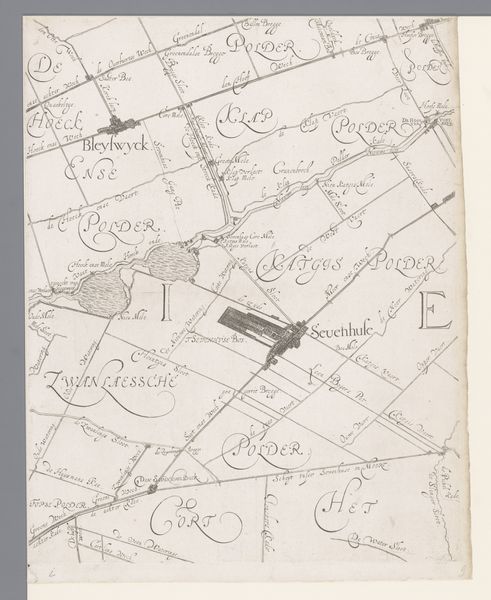
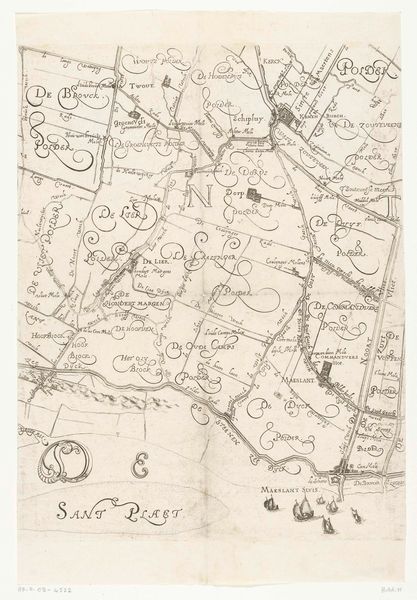
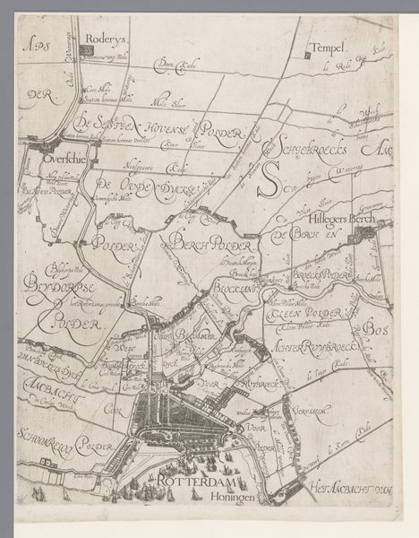
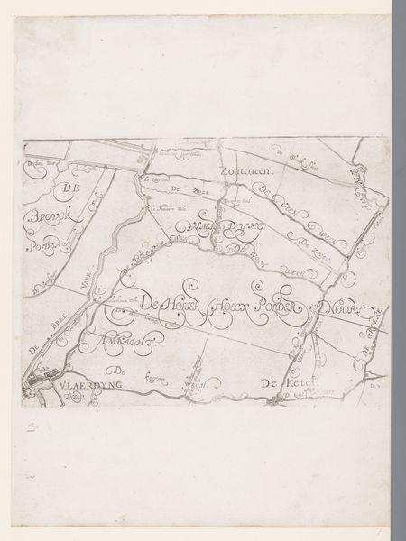
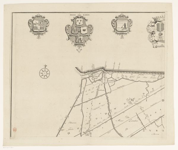
Kaart van het Hoogheemraadschap van Schieland, met De Zweth 1611 - 1635
florisbalthasarszvanberckenrode
Rijksmuseum
drawing, paper, ink
drawing
aged paper
toned paper
light pencil work
dutch-golden-age
sketch book
hand drawn type
landscape
paper
personal sketchbook
ink
ink drawing experimentation
geometric
pen-ink sketch
sketchbook drawing
sketchbook art
Dimensions: height 219 mm, width 293 mm
Copyright: Rijks Museum: Open Domain
Curator: This drawing, dating from between 1611 and 1635, offers us a fascinating look at the 'Map of the High Water Authority of Schieland, with De Zweth' by Floris Balthasarsz van Berckenrode. It's currently held in the Rijksmuseum collection. Editor: It strikes me as so delicate, like a whispered secret preserved on aged paper. The lines are incredibly fine, almost hesitant, yet they delineate this whole landscape. Curator: Indeed. The drawing is primarily ink on paper and gives us an indication of the water management systems crucial to the region. These polders reclaimed from the water, required constant maintenance and this map documents the responsibilities for different areas. Editor: I am particularly interested in its political implications. Who controlled these waterways controlled resources and influenced communities. This is a visualisation of power relations at a moment of rapid Dutch expansion, a map defining the very fabric of this new society. It begs the question of who was included and excluded from this mapped territory. Curator: That's a great point. We also see it representing a specific system of governance as the High Water Authority played a vital role in the young Republic. They were a form of local self-governance, distinct from aristocratic or monarchical control, influencing decision making processes. The precision employed indicates the importance of water management. Editor: Absolutely, a demonstration of a community investing in itself and its landscape, even if that community was limited to certain individuals. The style feels particularly 'Dutch Golden Age', almost stoic, which lends to my thoughts about governance at the time. It makes you wonder about what realities aren't included here in the landscape. Curator: The lack of human presence is notable. This really draws attention to how the landscape, at that time, was viewed from an objective and administrative standpoint. In other ways the map serves as a document to the power of humanity. Editor: Seeing this map certainly encourages thinking about these hidden socio-political and ecological tensions. Curator: A worthwhile reflection. The image shows both a literal terrain and metaphorical territory which gives the modern eye much to observe.
Comments
No comments
Be the first to comment and join the conversation on the ultimate creative platform.