About this artwork
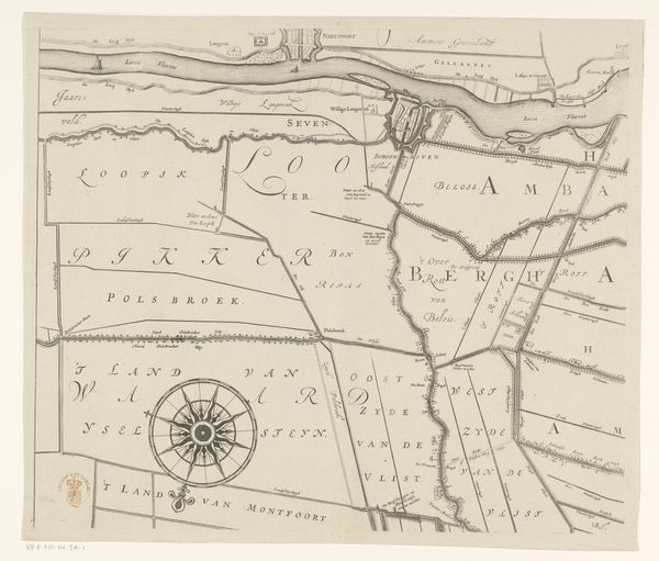
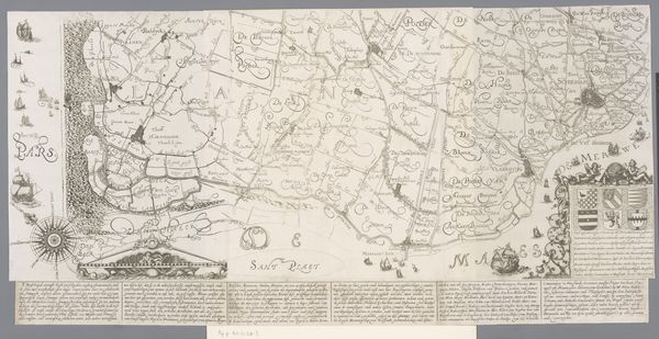
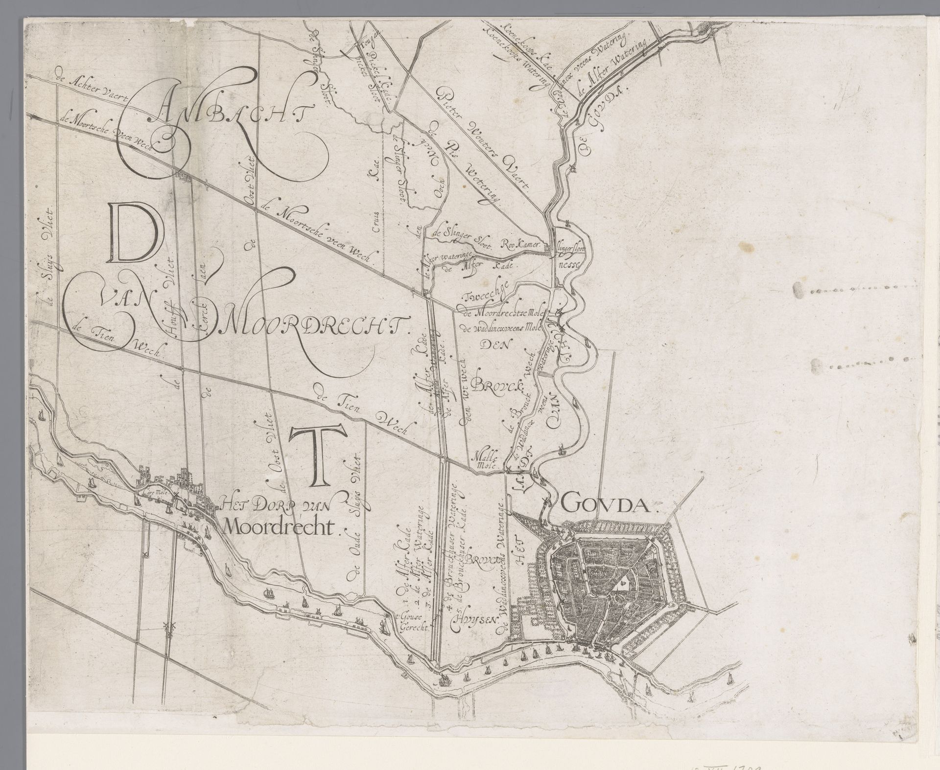
Curator: Here we have a remarkable piece: "Kaart van het Hoogheemraadschap van Schieland, met Gouda en Moordrecht," dating roughly from 1611 to 1635, made by Floris Balthasarsz van Berckenrode. It’s an ink drawing on paper. Editor: Immediately, I'm struck by how delicate the linework is. It feels almost… dreamlike, a landscape remembered rather than surveyed. Curator: In a way, you're right. Maps in this period weren't just about accuracy; they were about conveying power, ownership, and even aspiration. Look at the detail given to Gouda. The sharp lines depicting the bastion contrast with the watery, loose depictions of its watery environment. Editor: Indeed, that contrast highlights a fascination with controlling and organizing space, doesn’t it? You can almost feel the process—the handmade quality of it, each line drawn deliberately. What ink was typically used, I wonder? The color hints to gall ink… but of course, so many different possibilities with time. Curator: Precisely. And considering the importance of water management in the Schieland region—those drainage canals were vital! I imagine Berckenrode saw this work as more than just cartography. More so an imagining of how civilization tamed water, almost like a heroic struggle immortalized in ink. Editor: Which also speaks to a socio-economic layer of this work: consider how the control and maintenance of these waterways directly correlates to agrarian society. To chart the land, one must necessarily chart its workers too. A lot of it comes back to thinking about who benefits most from the art. Curator: It makes you think, doesn’t it? To create something that is useful, but has this aesthetic elegance, blurring that divide… It's truly captivating to consider, to stand here today at the Rijksmuseum and let it all wash over you. Editor: Absolutely. A convergence of nature, labor, material, and capital... What a view of seventeenth century Netherlands in a piece of drawing.
Kaart van het Hoogheemraadschap van Schieland, met Gouda en Moordrecht
1611 - 1635
Floris Balthasarsz van Berckenrode
1562 - 1616Location
RijksmuseumArtwork details
- Medium
- drawing, paper, ink
- Dimensions
- height 301 mm, width 389 mm
- Location
- Rijksmuseum
- Copyright
- Rijks Museum: Open Domain
Tags
Comments
Share your thoughts
About this artwork
Curator: Here we have a remarkable piece: "Kaart van het Hoogheemraadschap van Schieland, met Gouda en Moordrecht," dating roughly from 1611 to 1635, made by Floris Balthasarsz van Berckenrode. It’s an ink drawing on paper. Editor: Immediately, I'm struck by how delicate the linework is. It feels almost… dreamlike, a landscape remembered rather than surveyed. Curator: In a way, you're right. Maps in this period weren't just about accuracy; they were about conveying power, ownership, and even aspiration. Look at the detail given to Gouda. The sharp lines depicting the bastion contrast with the watery, loose depictions of its watery environment. Editor: Indeed, that contrast highlights a fascination with controlling and organizing space, doesn’t it? You can almost feel the process—the handmade quality of it, each line drawn deliberately. What ink was typically used, I wonder? The color hints to gall ink… but of course, so many different possibilities with time. Curator: Precisely. And considering the importance of water management in the Schieland region—those drainage canals were vital! I imagine Berckenrode saw this work as more than just cartography. More so an imagining of how civilization tamed water, almost like a heroic struggle immortalized in ink. Editor: Which also speaks to a socio-economic layer of this work: consider how the control and maintenance of these waterways directly correlates to agrarian society. To chart the land, one must necessarily chart its workers too. A lot of it comes back to thinking about who benefits most from the art. Curator: It makes you think, doesn’t it? To create something that is useful, but has this aesthetic elegance, blurring that divide… It's truly captivating to consider, to stand here today at the Rijksmuseum and let it all wash over you. Editor: Absolutely. A convergence of nature, labor, material, and capital... What a view of seventeenth century Netherlands in a piece of drawing.
Comments
Share your thoughts