print, etching, engraving
#
pen and ink
# print
#
etching
#
old engraving style
#
landscape
#
etching
#
history-painting
#
academic-art
#
engraving
Dimensions: height 598 mm, width 639 mm
Copyright: Rijks Museum: Open Domain
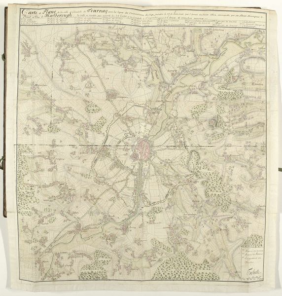
Philippe Joseph Maillart created this map of the Battle of Waterloo in 1815. Notice how thin lines form a network of roads and rivers, with green patches indicating forests that break up the landscape. These features structure the composition and create a sense of depth. The map functions through a semiotic system of signs. Each element, from the placement of forests to the rendering of settlements, serves as a visual signifier. These signs guide the viewer through the theater of war, charting the movements and positions of armies. The rigid structure offers a perspective that seeks to contain the chaos and uncertainty of the battlefield within a clear, rational framework. Consider how the act of mapping itself imposes a certain order on the world, transforming fluid events into fixed representations. This map reduces the complexities of human conflict to a series of strategic points, lines, and boundaries, providing a framework for understanding the battle and reflecting a desire to control and make sense of historical events.
Comments
No comments
Be the first to comment and join the conversation on the ultimate creative platform.
More like this