drawing, print, ink, engraving
#
drawing
#
dutch-golden-age
# print
#
landscape
#
ink
#
engraving
Dimensions: height 560 mm, width 505 mm
Copyright: Rijks Museum: Open Domain
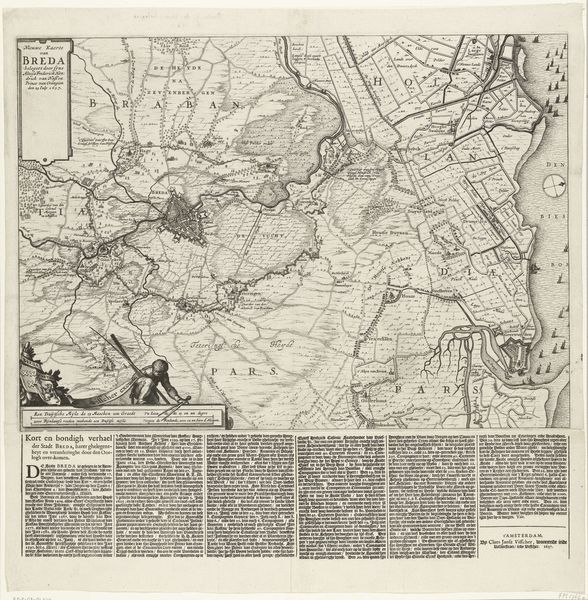
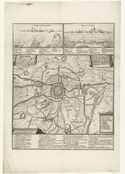
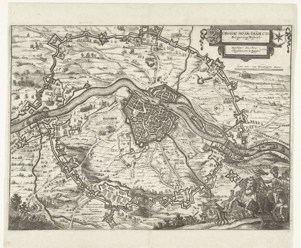
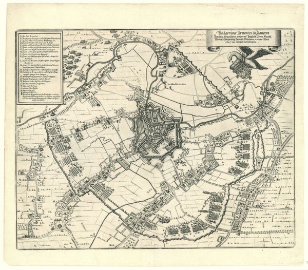
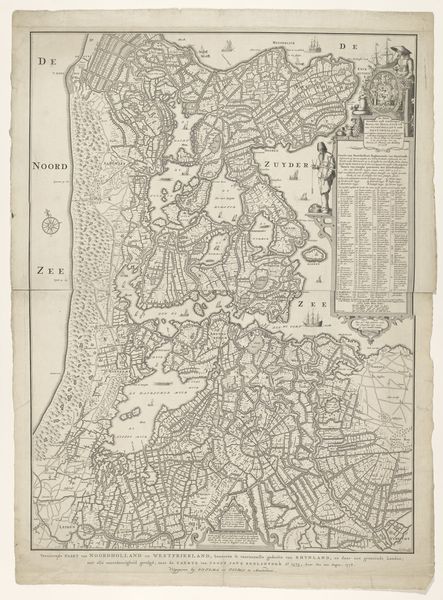
Claes Jansz. Visscher created this map of the siege of Breda in 1637. The detailed engraving uses line and form to construct a landscape both informative and evocative. Observe how Visscher uses a high vantage point to flatten the scene, creating an almost abstract pattern. He uses line to demarcate fields, waterways, and fortifications. The texture varies from the dense hatching of the city itself to the sparser rendering of the open fields. The composition is divided into distinct zones, each conveying different types of information, from the main map to the inset plan of the city's defenses, to the blocks of descriptive text below. As a visual document this map speaks to early modern Europe's fascination with spatial representation. Yet, beyond its practical function, Visscher's map also reflects a subtle interplay between objective observation and artistic interpretation. Note how the carefully balanced composition transforms the theater of war into a compelling visual narrative.
Comments
No comments
Be the first to comment and join the conversation on the ultimate creative platform.
More like this