print, engraving
baroque
landscape
history-painting
engraving
Dimensions: height 420 mm, width 475 mm
Copyright: Rijks Museum: Open Domain
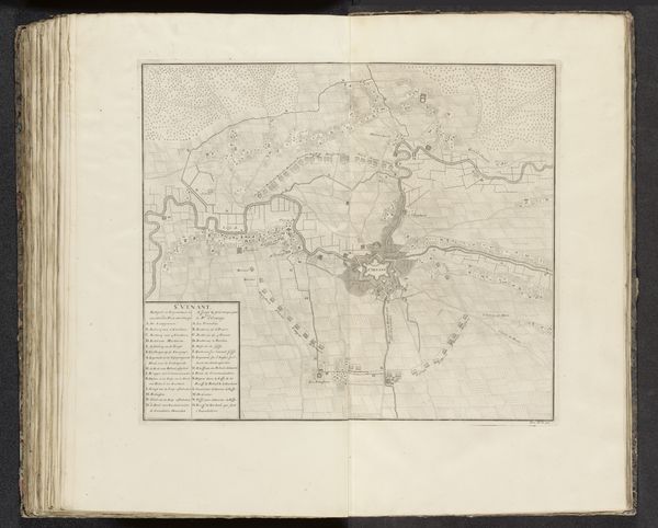
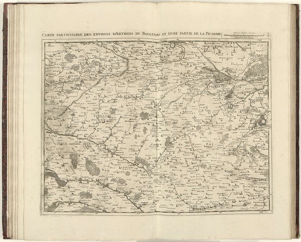
Editor: So, here we have “The Siege of Saint-Venant, 1710,” by Pieter Devel, an engraving on, I'm assuming, paper. It's stark, almost sterile. I can feel the strategy and the calculation in the lines, but there's a coldness, an unsettling distance from the human cost. What leaps out at you? Curator: It reminds me of peering into an ant farm—you’re privy to all the bustling activity but utterly disconnected from the individual drama. Look closely, and the 'sterility' you mentioned transforms. Each line represents human intention, struggle, ambition... tiny narratives writ large across the land. It's like a frozen opera. What stories do *you* think are etched within those lines? Editor: That’s beautiful, "a frozen opera." I suppose each of those tiny fortifications or troop deployments could represent a critical decision, a desperate defense, maybe even a moment of individual heroism? I hadn’t thought of it that way. The legend helps bring a certain precision. Curator: Exactly. And precision isn't antithetical to drama! This isn't just about documenting; it's about memorializing a pivotal moment. Even the landscape participates, guiding the battle like a silent character. It prompts a question, doesn’t it, of how 'objective' any depiction of history truly is. Is the map-maker telling a story, beyond simple geography? Editor: So it’s like the map-maker is a silent historian who injects a personal bias into the work? Curator: Precisely. Every line weight, every angle of view speaks volumes. Editor: Thinking of it as a blend of calculation and a historical record has opened my eyes. Thank you! Curator: And for me, a reminder of how much we project onto these 'objective' documents. Wonderful!
Comments
No comments
Be the first to comment and join the conversation on the ultimate creative platform.