graphic-art, print, etching
#
graphic-art
#
baroque
# print
#
etching
#
landscape
#
etching
#
cityscape
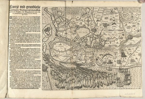
Dimensions: height 710 mm, width 650 mm
Copyright: Rijks Museum: Open Domain
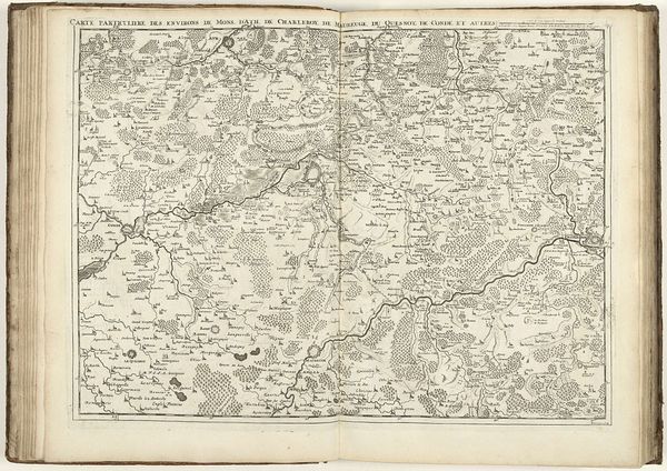
Samuel Du Ry de Champdoré produced this image of the Siege of Tournai, as it happened in 1709. This map provides an overhead view of the siege, detailing the layout of the city, the positions of the attacking forces, and the surrounding landscape. Made in the Netherlands during the early 18th century, this document gives us insight into the military strategies and urban planning of the time. The detailed mapping of Tournai and its environs reflects the importance of cartography in military operations, and in the political control of territory. The map is not just a tool for military planning, but also a statement of power, asserting control over space and resources. Historical maps such as this one can be analysed as cultural artifacts. Through careful examination of such images in the archives we can better understand the complex interplay between art, power, and knowledge in early modern Europe.
Comments
No comments
Be the first to comment and join the conversation on the ultimate creative platform.
More like this