graphic-art, print, engraving
graphic-art
ink drawing
medieval
pen drawing
line
engraving
Dimensions: height 440 mm, width 565 mm
Copyright: Rijks Museum: Open Domain
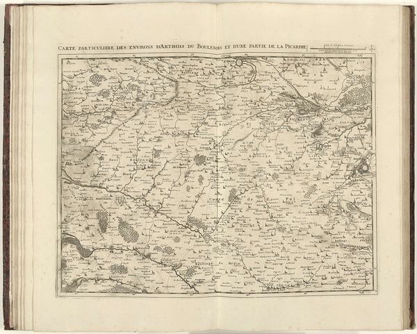
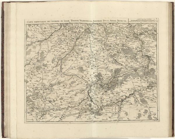
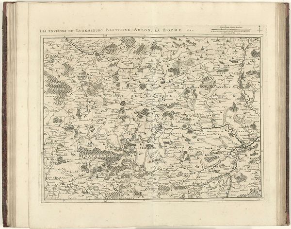
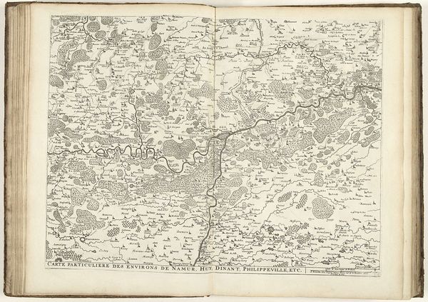
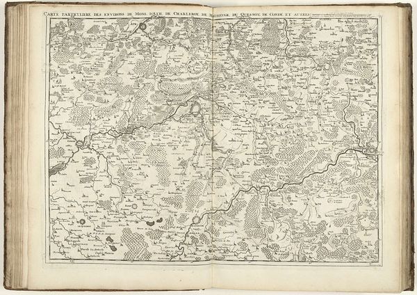
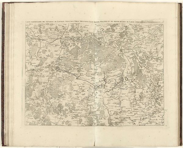
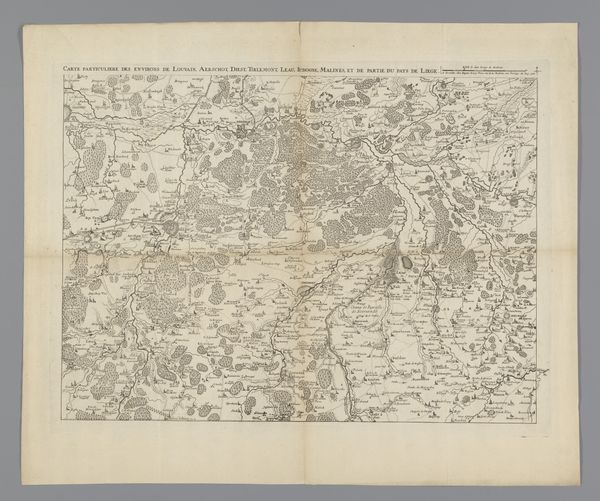
Curator: Here in the Rijksmuseum, we have Jacobus Harrewijn's 1710 map, titled "Kaart van West-Vlaanderen," a detailed engraving of the West Flanders region. The artistry in this map is so intricate; it looks almost like an aerial view, painstakingly rendered with line and stipple techniques. Editor: It's mesmerizing. The sheer density of information conveyed through those delicate lines! It makes me think about accessibility and power. Who was this map intended for, and what did access to this knowledge mean in the 18th century? Curator: Maps in this period were certainly tools of power, used by elites for administrative, military, and economic purposes. This one shows settlements, waterways, and topographical features that would be critical for governance and resource management. Editor: Right, it's not just a pretty picture. But thinking about the political climate, West Flanders was frequently a battleground. So, I wonder about its role in solidifying claims of authority amidst ongoing conflict. How did this influence local inhabitants or challenge colonial powers? Curator: The very act of mapping could reinforce a sense of ownership and control, impacting those who lived within that charted territory. While it depicts tangible terrain, these representations played a crucial role in asserting dominion during shifting European politics. Editor: Which then makes it a historical actor, a physical object that participated in social domination. How can we rethink it to reveal these hidden processes? This object could give the Flemish a new self-awareness, so that they could better express the need to reclaim spaces and territories from global capital. Curator: Looking at it in that critical lens encourages us to ask more about how geographical understanding shapes cultural identity and, as you say, resistance. The artist clearly invested considerable effort in achieving precision, perhaps even a sense of pride. Editor: Indeed. And while such accuracy seems inherently "objective," we must recall that representation is never neutral. It’s fascinating how the simple lines can have such embedded meanings, so charged with political consequence. Curator: Well, approaching Harrewijn’s map, not merely as an aesthetic piece but also as a component of broader historical and social processes, has made it a truly insightful experience. Editor: Precisely! It urges us to keep looking critically at these seemingly immutable narratives that maps can solidify.
Comments
No comments
Be the first to comment and join the conversation on the ultimate creative platform.