print, engraving
#
dutch-golden-age
# print
#
cityscape
#
engraving
Dimensions: height 261 mm, width 362 mm
Copyright: Rijks Museum: Open Domain
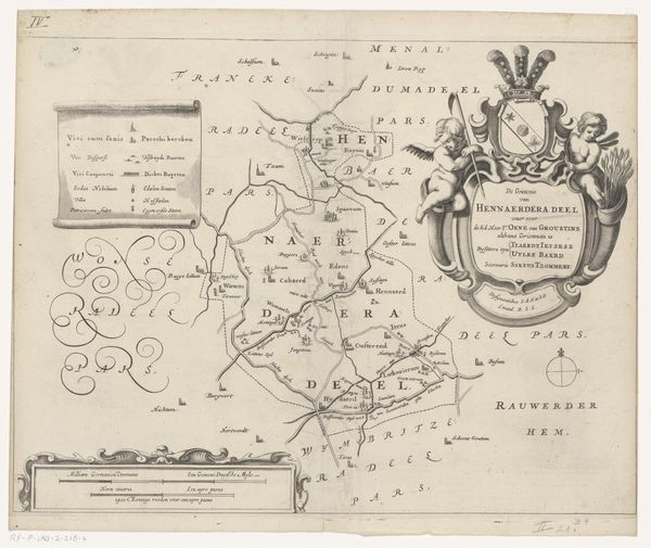
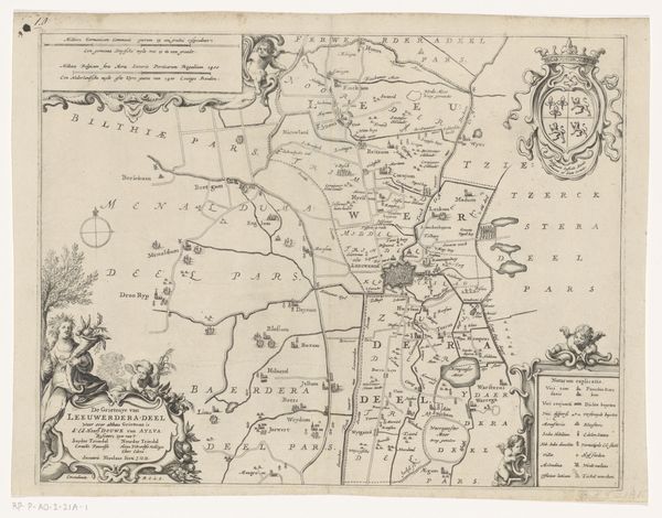
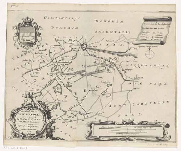
Here we have Jacob van Meurs’s copperplate engraving, "Map of the Baarderadeel Grietenij," made sometime between 1640 and 1680. Van Meurs worked during the Dutch Golden Age, a time of unprecedented economic growth and cultural flourishing in the Netherlands, which also saw the rise of cartography as both a science and an art form. Maps like this one weren't just geographical tools; they were also powerful symbols of identity and control. The detailed depiction of the Baarderadeel region, including its villages, waterways, and administrative boundaries, reflects the Dutch Republic’s careful attention to governance and land management. Note the elaborate coat of arms and ornamental details, typical of the period, which elevate the map to something more than a mere record, becoming a statement of regional pride. However, this map also participates in the historical narrative of colonization and trade, indirectly tied to the same era that brought the Dutch East India Company to prominence. This reminds us that even seemingly neutral documents like maps are embedded with the complex relationships between power, knowledge, and identity. We might think about the human stories of those who lived and worked in this region, and how their lives were shaped by these representations of their land.
Comments
No comments
Be the first to comment and join the conversation on the ultimate creative platform.
More like this