About this artwork
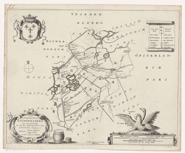
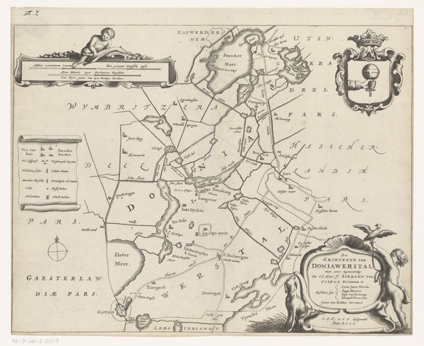
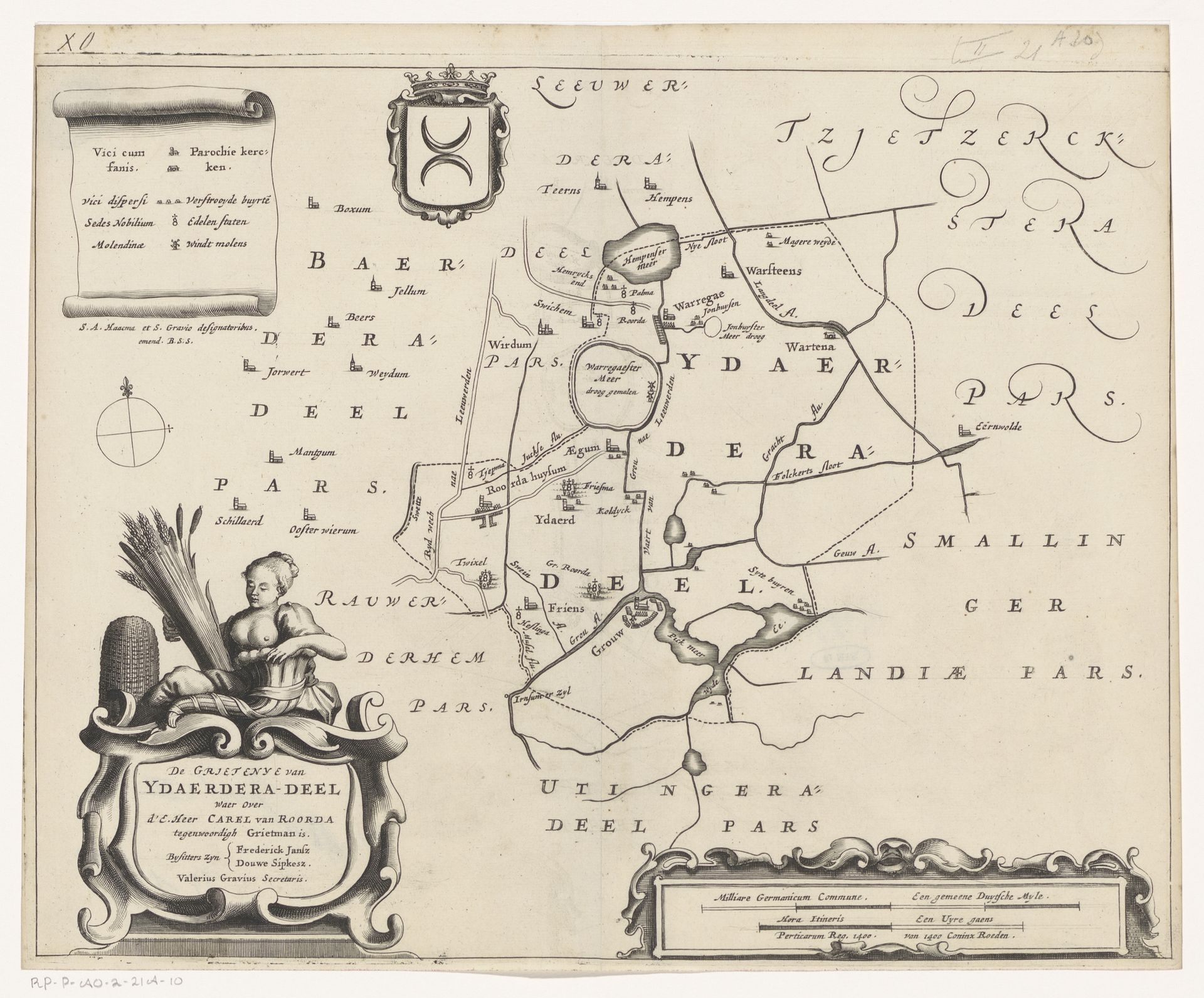
Curator: Here we have a 1664 engraving by Jacob van Meurs, "Kaart van de grietenij Idaarderadeel," a map of the Idaarderadeel region. The precision and artistry are striking, aren’t they? Editor: Yes, it's incredible! I’m really drawn to the allegorical figure and cartouche in the bottom corner. What can you tell me about the social context that shaped this kind of detailed map-making? Curator: That’s a fantastic observation. We need to situate this map within the Dutch Golden Age, a period of immense economic and colonial expansion. Maps weren’t just geographic tools; they were instruments of power. This detailed mapping reflects an intense engagement with claiming and administering territory. How does that tension between aesthetics and political function resonate with you? Editor: It makes me think about the indigenous populations in these regions. Were their perspectives and knowledge systems acknowledged, or were they completely erased in this European cartographic project? Curator: Exactly! That’s a crucial point to consider. Whose voices are centered, and whose are marginalized? The map's beauty can mask the fact that it was produced in a context of resource extraction and potentially displacement. What effect does acknowledging the imbalance have on your reading? Editor: It certainly complicates the viewing experience. I can't ignore the power dynamics at play anymore; it becomes more than just a beautiful old map. It prompts necessary questions about colonialism and representation. Curator: And that discomfort, that questioning, is precisely where critical engagement with art history begins. Editor: It has certainly changed the way I see these historical documents. I realize it's important to appreciate their aesthetic value while simultaneously interrogating the circumstances of their creation. Curator: Precisely! This pushes us to think critically about how visual culture can reinforce existing power structures and where these interventions can be brought to bear.
Artwork details
- Medium
- print, engraving
- Dimensions
- height 286 mm, width 366 mm
- Location
- Rijksmuseum
- Copyright
- Rijks Museum: Open Domain
Tags
Comments
Share your thoughts
About this artwork
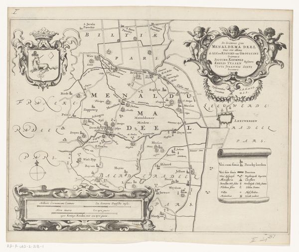
Curator: Here we have a 1664 engraving by Jacob van Meurs, "Kaart van de grietenij Idaarderadeel," a map of the Idaarderadeel region. The precision and artistry are striking, aren’t they? Editor: Yes, it's incredible! I’m really drawn to the allegorical figure and cartouche in the bottom corner. What can you tell me about the social context that shaped this kind of detailed map-making? Curator: That’s a fantastic observation. We need to situate this map within the Dutch Golden Age, a period of immense economic and colonial expansion. Maps weren’t just geographic tools; they were instruments of power. This detailed mapping reflects an intense engagement with claiming and administering territory. How does that tension between aesthetics and political function resonate with you? Editor: It makes me think about the indigenous populations in these regions. Were their perspectives and knowledge systems acknowledged, or were they completely erased in this European cartographic project? Curator: Exactly! That’s a crucial point to consider. Whose voices are centered, and whose are marginalized? The map's beauty can mask the fact that it was produced in a context of resource extraction and potentially displacement. What effect does acknowledging the imbalance have on your reading? Editor: It certainly complicates the viewing experience. I can't ignore the power dynamics at play anymore; it becomes more than just a beautiful old map. It prompts necessary questions about colonialism and representation. Curator: And that discomfort, that questioning, is precisely where critical engagement with art history begins. Editor: It has certainly changed the way I see these historical documents. I realize it's important to appreciate their aesthetic value while simultaneously interrogating the circumstances of their creation. Curator: Precisely! This pushes us to think critically about how visual culture can reinforce existing power structures and where these interventions can be brought to bear.
Comments
Share your thoughts