graphic-art, print, etching, engraving
#
graphic-art
#
baroque
# print
#
etching
#
landscape
#
cityscape
#
engraving
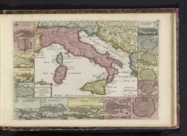
Dimensions: height 48.8 cm, width 56.7 cm
Copyright: Rijks Museum: Open Domain
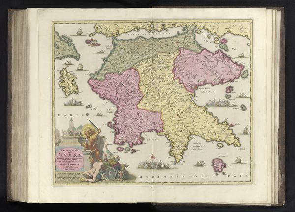
This is Frederik de Wit’s map of Italy, created around the late 17th century. Look at the cartouche—an ornamental frame, where putti surround a female figure, representing Italy herself. She holds a cornucopia, a horn overflowing with fruit and flowers, an ancient symbol of abundance and prosperity. The cornucopia’s roots lie in classical antiquity, often associated with deities of plenty like Fortuna. We see it depicted in Roman frescoes, carried by figures representing the bounty of the empire, which, in turn, echoes earlier Greek concepts of fertility and divine favor. Over time, this emblem has recurred in various forms, from Renaissance paintings to modern-day emblems, each era imbuing it with its own specific cultural and political significance. Consider the psychological weight of such imagery. The cornucopia, even subconsciously, evokes feelings of security and well-being, tapping into our primal desire for sustenance and wealth. It's a powerful symbol that transcends time, continually resurrected to stir our deepest emotions.
Comments
No comments
Be the first to comment and join the conversation on the ultimate creative platform.
More like this