drawing, graphic-art, print, paper
#
drawing
#
graphic-art
#
neoclacissism
# print
#
paper
#
geometric
#
cityscape
#
realism
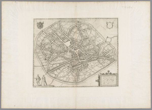
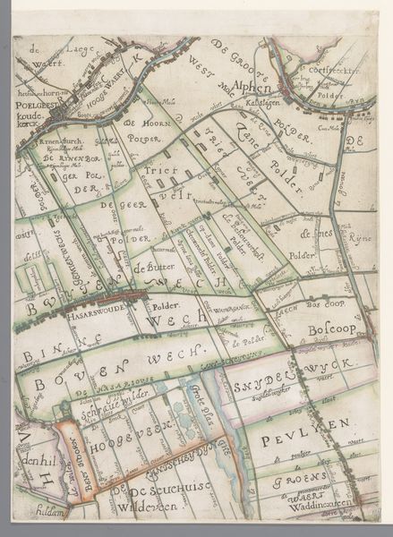
Dimensions: height 335 mm, width 435 mm
Copyright: Rijks Museum: Open Domain
This is an undated map of Brussels, rendered anonymously with ink and watercolour on paper. The work presents a bird's-eye view of the city, its form constrained within an irregular oval. The composition is structured by a network of fine lines indicating streets and waterways, colored in muted greens, yellows, and reds that create a delicate visual harmony. The city's layout is highly formalized, with a clear distinction between densely packed urban areas and more open, geometric parks. This cartographic representation reduces the city to a set of signs, a semiotic system where each line and color encodes specific information about urban space and infrastructure. This map's formal organization reflects broader philosophical concerns about urban planning and social order during its time. The visual structure, in its attempt to categorize and organize the city, engages with prevailing ideas about power, knowledge, and representation. The map serves not just as a navigational tool but as an assertion of control over the urban environment.
Comments
No comments
Be the first to comment and join the conversation on the ultimate creative platform.
More like this