About this artwork
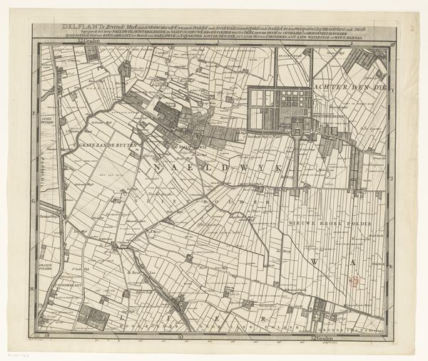
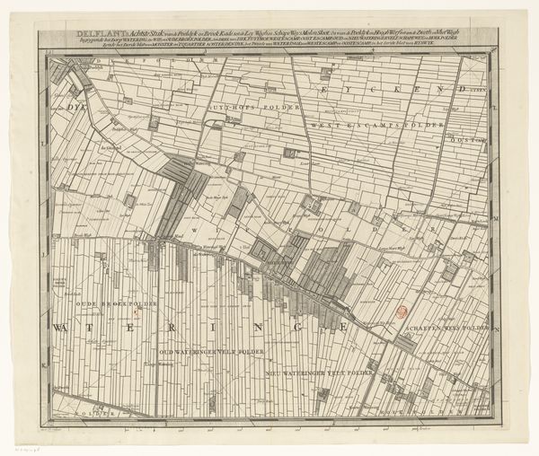
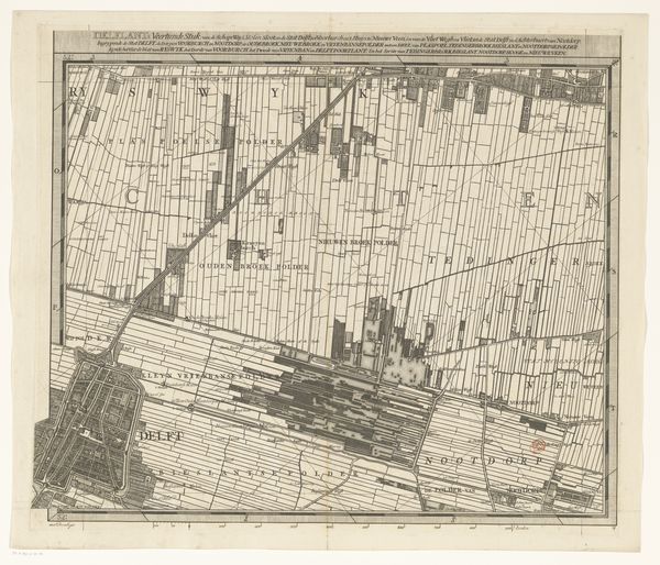
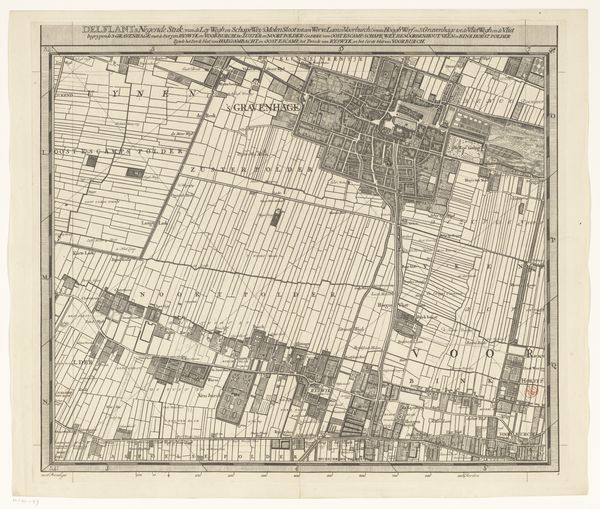
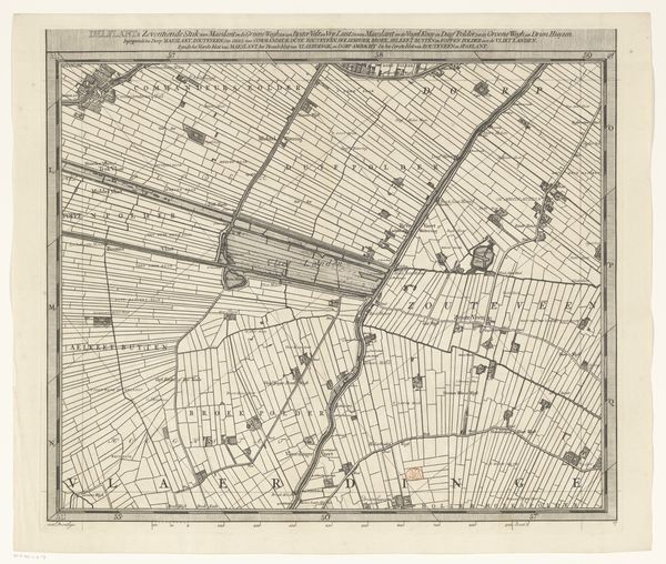
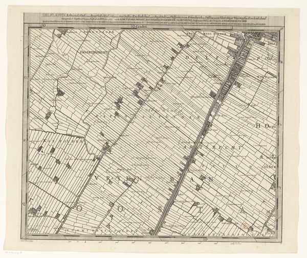
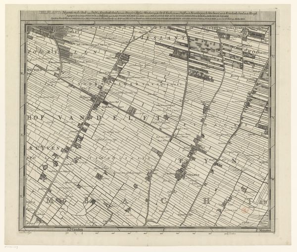
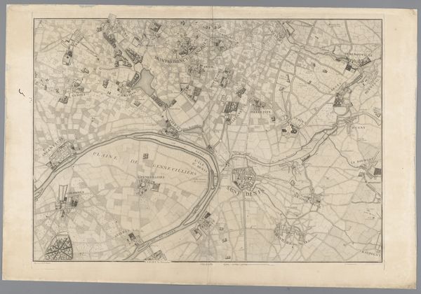
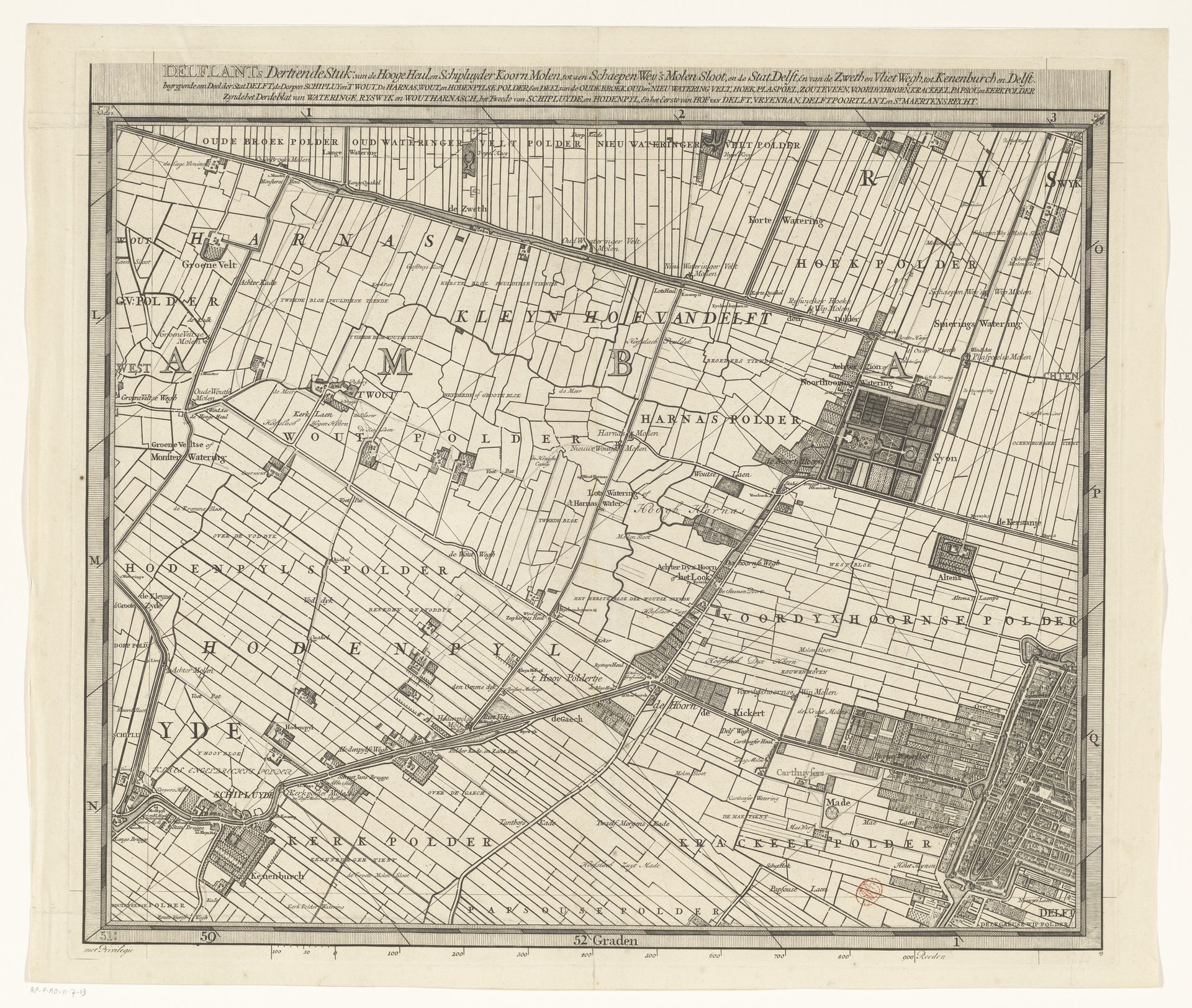
Luggert van Anse created this map of Delfland. It is a complex interplay of lines and spaces that evoke the structured, yet organic landscape of the region. The composition is dominated by a grid-like pattern, where each rectangle represents a parcel of land. The use of line in this work is particularly striking. Notice how each line, whether defining a field, a canal, or a road, is rendered with a delicate precision, creating a web of interconnected elements. This is not merely a representation of space; it is a semiotic system, a set of signs pointing to the human imposition on nature. In its structural organization, the map challenges traditional ideas about space and perception. The consistent application of line and the absence of conventional shading destabilize the illusion of depth, flattening the landscape into an abstract composition. This formal decision transforms the map from a mere navigational tool into a complex cultural artifact. It highlights our ongoing engagement with interpreting and reimagining the world around us.
Kaart van het Hoogheemraadschap van Delfland (dertiende deel) 1712 - 1735
Artwork details
- Dimensions
- height 518 mm, width 598 mm
- Copyright
- Rijks Museum: Open Domain
Tags
architectural sketch
aged paper
map drawing
old engraving style
architectural diagram
architectural plan
architectural section drawing
architectural drawing
architecture drawing
architectural proposal
Comments
No comments
About this artwork
Luggert van Anse created this map of Delfland. It is a complex interplay of lines and spaces that evoke the structured, yet organic landscape of the region. The composition is dominated by a grid-like pattern, where each rectangle represents a parcel of land. The use of line in this work is particularly striking. Notice how each line, whether defining a field, a canal, or a road, is rendered with a delicate precision, creating a web of interconnected elements. This is not merely a representation of space; it is a semiotic system, a set of signs pointing to the human imposition on nature. In its structural organization, the map challenges traditional ideas about space and perception. The consistent application of line and the absence of conventional shading destabilize the illusion of depth, flattening the landscape into an abstract composition. This formal decision transforms the map from a mere navigational tool into a complex cultural artifact. It highlights our ongoing engagement with interpreting and reimagining the world around us.
Comments
No comments