mixed-media, painting, paper
mixed-media
dutch-golden-age
painting
landscape
paper
geometric
Dimensions: height 479 mm, width 853 mm
Copyright: Rijks Museum: Open Domain
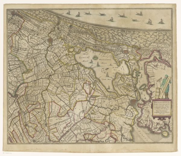
Curator: Take a look at "Kaart van de provincie Utrecht en de Veluwe," a mixed-media map created sometime between 1682 and 1702 by Luggert van Anse. Editor: It’s intriguing how the different territories are color-coded, almost like fields for harvesting materials. I find the neat geometry contrasting with the wild suggestion of the uncultivated spaces powerful. Curator: Notice the meticulous detail in depicting land divisions and settlements. For a materialist perspective, the sheer labor and resource expenditure in creating something like this, during this time period, is compelling. The quality of paper and pigment reveals how this knowledge was considered something valuable and worth protecting. Editor: The coat of arms at the top, elaborately framed, hints at power, ownership, and territorial ambition. Look how they are deliberately placed to dominate and oversee the landscape below! These emblems function as declarations of status and reinforce social hierarchies. Curator: Exactly, and consider how that is echoed in the methods of production and dissemination. Cartography, here, functions as an instrument of control. Who could commission and own such detailed depictions? Maps become less about true depictions of reality and are instead symbols of control. Editor: What interests me is how geographical features, such as rivers, become almost mythological characters through symbolic representation, defining identity and creating narratives tied to those places. Note the scale used for depiction of these locations: these choices carry great historical weight in this visualization of territory! Curator: I agree, the interplay of objective representation and symbolic language provides this artwork a specific aura. You become acutely aware of the labor involved. It causes you to rethink concepts about value or functionality, and the context of this kind of artistry provides deeper value for all of us to consider. Editor: This has offered new perspectives on the psychological importance of place and representation, highlighting how maps are not neutral documents.
Comments
No comments
Be the first to comment and join the conversation on the ultimate creative platform.
More like this