graphic-art, print, engraving
#
graphic-art
#
page thumbnail
#
dutch-golden-age
# print
#
old engraving style
#
landscape
#
detailed illustration
#
pen work
#
coloring book page
#
engraving
#
botanical art
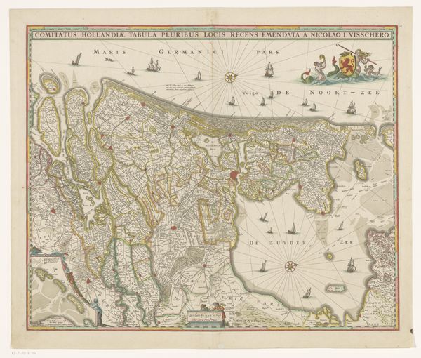
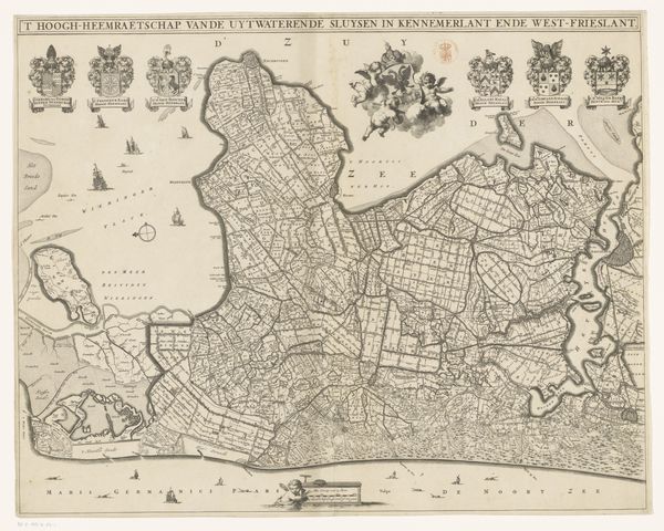
Dimensions: height 463 mm, width 563 mm
Copyright: Rijks Museum: Open Domain
This map of the County of Holland was made by Frederik de Wit around the 17th century. Such maps were not simply geographical tools; they were powerful visual statements of political and economic control, defining territories and asserting ownership. Made during the Dutch Golden Age, this map reflects the Netherlands' booming maritime power and mercantile success. The presence of sailing ships and a compass rose emphasizes the importance of seafaring and trade routes. The detailed depiction of cities and waterways highlights the region's economic infrastructure. It's worth noting that maps like these also played a role in shaping national identity and historical narratives. They served as a form of propaganda, reinforcing the authority of the ruling powers and shaping perceptions of the world. To understand this map fully, we can consult historical archives, trade records, and political documents. The meaning of this artwork lies not only in its aesthetic qualities but also in its historical context and its role in shaping social and institutional power.
Comments
No comments
Be the first to comment and join the conversation on the ultimate creative platform.
More like this