print, etching, engraving
#
aged paper
#
yellowing background
#
dutch-golden-age
#
parchment
# print
#
etching
#
old engraving style
#
landscape
#
engraving
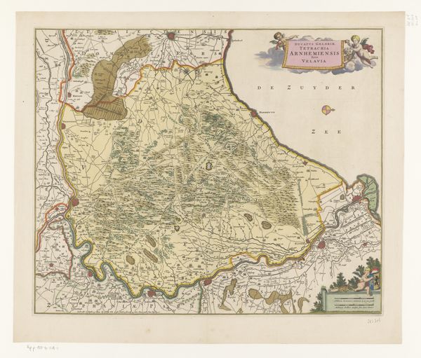
Dimensions: height 400 mm, width 499 mm
Copyright: Rijks Museum: Open Domain
Editor: This is the "Kaart van het Brugse Vrije," a map from 1633, made anonymously, and it’s an etching or engraving. I find it really striking how much detail they crammed into it; it looks so different from our modern maps. What strikes you about this piece? Curator: Well, for me, this map is really fascinating as a document of its time. Let's think about what went into producing something like this in the 17th century. It's not just about geographical accuracy; it’s about labor. The process of surveying the land, creating the printing plate, and then the actual printing process - each step represents human effort and skill. Do you think the consumer who would use this appreciates that effort? Editor: Probably not directly, but it seems the value and craft put into the process would be reflected in the finished piece and it’s utility? I also imagine owning such a map implied a level of wealth and access. Curator: Exactly! And beyond that, think about the materials: paper, ink, the tools for engraving. These all have their own histories, their own networks of trade and production. This isn't just an image, it's a product deeply embedded in the economic and social fabric of the 17th century. How might control of material have played into this as well? Editor: Control, you mean as in power? Since maps represent territory, producing this map can be seen as claiming dominion over a region through materials and processes. And maybe advertising one's own? Curator: Precisely. The map as an object becomes a tool of power, a form of asserting control over the landscape and its resources. Editor: So it's not just about seeing the world, it's about shaping it, too. I never considered maps that way. Curator: Indeed! Hopefully, this enriches the map-viewing experience moving forward!
Comments
No comments
Be the first to comment and join the conversation on the ultimate creative platform.
More like this