print, paper, ink, engraving
#
ink paper printed
# print
#
paper
#
ink
#
geometric
#
pen work
#
cityscape
#
history-painting
#
engraving
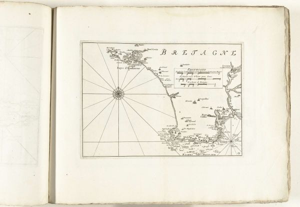
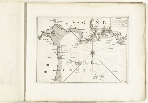
Dimensions: height 229 mm, width 250 mm
Copyright: Rijks Museum: Open Domain
This map of the south coast of Brittany near Vannes was made in 1726 by an anonymous artist through etching. The appearance of this map is directly influenced by the qualities of the etching process. The artist would have used a sharp needle to scratch directly into a wax-coated metal plate, before submerging it in acid. This etches the exposed lines into the metal, which is then inked and printed. The incised lines give the map its crisp, precise detail, essential for nautical navigation. This process, requiring careful preparation and skilled hand-work, highlights the labor involved in producing cartographic knowledge. The final map is not just an image, it's a document produced through a combination of technical expertise, artistry, and the demands of maritime trade. By recognizing the significance of materials, making, and context, we can better understand the full meaning of an artwork.
Comments
No comments
Be the first to comment and join the conversation on the ultimate creative platform.
More like this