graphic-art, print, engraving
#
graphic-art
#
baroque
# print
#
landscape
#
geometric
#
line
#
history-painting
#
academic-art
#
engraving
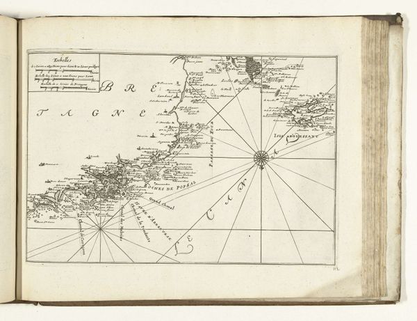
Dimensions: height 221 mm, width 330 mm
Copyright: Rijks Museum: Open Domain
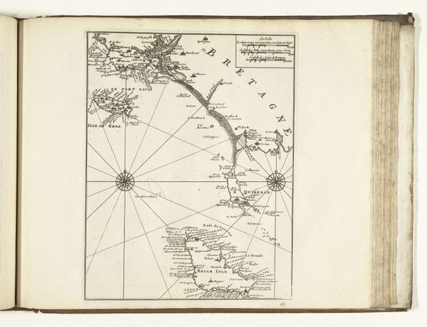
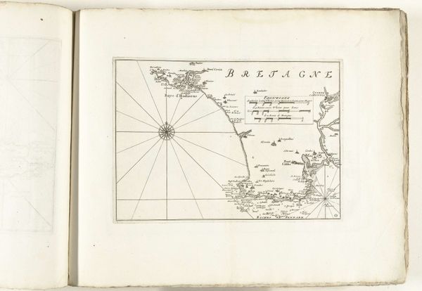
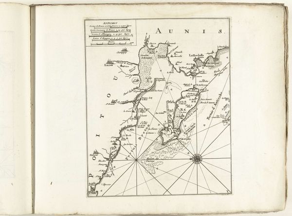
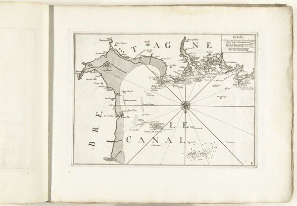
Editor: So, here we have a map, titled "Kaart van de Franse kust tussen Barfleur en Bayeux, 1726," from an anonymous artist, held at the Rijksmuseum. It’s an engraved print and has a very stark, geometric quality. It makes me wonder about the function of map-making back then. What strikes you most about this piece? Curator: Considering the historical context, this isn't just a representation of geography; it's a product of labour and political power. Look at the fineness of the engraving – the skill, the time invested. Who was commissioning these maps, and what purpose did they serve beyond navigation? Was it simply a functional instrument for maritime use, or a tool of colonial domination? Editor: That's a good point, especially since it’s a map of the French coast made by an anonymous artist – we can’t really trace it back. You almost see the materials – the ink, paper, metal plates used for engraving – as historical artifacts in themselves. How might we read this object through its means of production? Curator: Exactly! Think about the engraver’s skill, compared to, say, a print made with inexpensive materials, or mass produced... What social class did the engraver belong to? Where would a print like this be circulated? The materials, the printing press itself: These all represent labor that’s not immediately evident. Was this particular map intended for a wealthy merchant, the navy, or public distribution? Editor: Right, thinking about where it would have been consumed – if it’s for military strategy, that changes our view. The value and prestige comes from something very different than decorative art. It shifts how you think about landscape art in general. Curator: Precisely. We understand artistic and social context by looking at the conditions of its production. I wonder how different the perception of the represented coastal territory looked to the various stakeholders, even down to the engraver and the consumer. Editor: That's made me rethink what a 'simple' map could represent! Thanks for drawing my attention to those broader ideas around artistic intention and dissemination.
Comments
No comments
Be the first to comment and join the conversation on the ultimate creative platform.
More like this