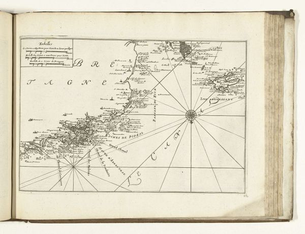
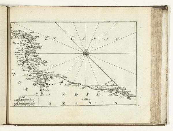
Kaart van de Franse westkust bij La Rochelle en Ile de Ré, ca. 1702 1702 - 1703
0:00
0:00
anonymous
Rijksmuseum
#
comic strip sketch
#
pen illustration
#
pen sketch
#
personal sketchbook
#
ink drawing experimentation
#
pen-ink sketch
#
pen work
#
sketchbook drawing
#
storyboard and sketchbook work
#
sketchbook art
Dimensions: height 285 mm, width 235 mm
Copyright: Rijks Museum: Open Domain
Curator: Look closely at this fascinating chart. It's titled "Kaart van de Franse westkust bij La Rochelle en Ile de Ré", which translates to "Map of the French west coast near La Rochelle and Île de Ré", and was created around 1702 or 1703. Editor: It reminds me of something a pirate might unfold in a dimly lit cabin! A quest map, perhaps, more evocative than purely informative. Curator: Indeed! Although seemingly straightforward, maps like this held immense symbolic weight. In a time of exploration and naval power, a chart wasn't just about navigation; it was a claim of ownership, an assertion of knowledge and dominance. Notice the compass rose—more than just a direction indicator, it symbolizes order and control over the vastness of the ocean. Editor: The way the landmasses are rendered, so detailed along the coast but almost dissolving inland, gives me the sense of the sea being the thing, the important part of the story. And all those little handwritten notes, like tiny secrets whispered on the wind! I imagine this could've been annotated directly during sea voyages, little changes. Curator: Absolutely. The very act of mapping, recording coastlines, depths, and hazards, established power. Each named place reinforces the cultural narrative. Editor: It’s amazing how the absence of color almost amplifies the drama. It’s just black ink scratching out this world that’s now frozen on a creamy-white surface. I also love how everything has been handwritten! And the quality of the drawing is incredibly detailed. It is the kind of art you find by accident in some anonymous sketchbook and that speaks to you deeply. Curator: You're right to focus on the "personal sketchbook" feeling of the piece. This reflects not just cartographic precision, but also the personal investment in geographical knowledge of that time. One feels like it may contain so many details, the memory and continuity of entire towns and trade routes. Editor: Thinking about this map and our conversation... it's like we've been navigating our way through both land and story. What was only a static historical artifact becomes something vital and emotionally resonant.
Comments
No comments
Be the first to comment and join the conversation on the ultimate creative platform.
More like this