print, engraving
# print
#
landscape
#
history-painting
#
engraving
Dimensions: height 229 mm, width 311 mm
Copyright: Rijks Museum: Open Domain
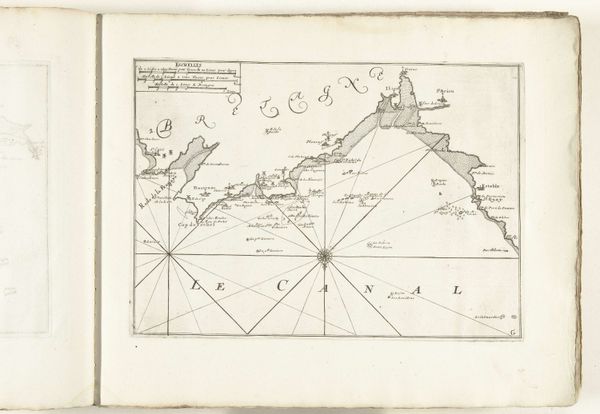
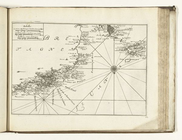
This is an anonymous map of the French coast near Mont-Saint-Michel, created around 1702. Dominating the composition, the compass rose is not merely a navigational aid; it is a symbol steeped in history. Its radiating lines echo ancient solar symbols, representing not just direction but also enlightenment and orientation in a broader sense. Consider the labyrinthine path of Theseus, guided by Ariadne's thread, or the spiritual journey towards inner understanding. These motifs reappear across cultures, from the sun wheels of antiquity to the intricate mandalas of Eastern traditions. The compass rose, thus, becomes a potent symbol of guidance, deeply embedded in our collective unconscious. However, as the ages turn, this symbol undergoes a metamorphosis, its spiritual essence gradually overtaken by practical concerns. This evolution reflects humanity's shifting focus from the divine to the empirical, a poignant reminder of how cultural memory is constantly reshaped by the currents of time.
Comments
No comments
Be the first to comment and join the conversation on the ultimate creative platform.
More like this