drawing, print, paper, ink, engraving
#
drawing
# print
#
landscape
#
paper
#
ink
#
geometric
#
history-painting
#
engraving
Dimensions: height 225 mm, width 332 mm
Copyright: Rijks Museum: Open Domain
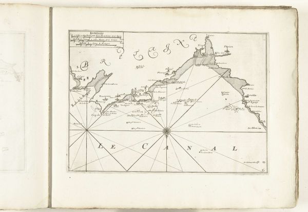
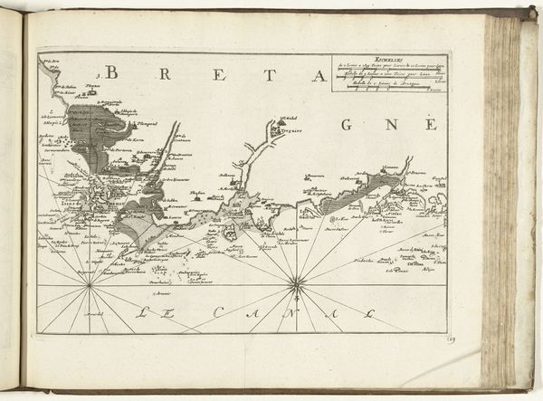
This map of the coast of Gascogne was created anonymously in 1726. It is an engraving, so a design was etched into a metal plate, which was then inked and printed onto paper. Engraving was a highly skilled and specialized craft, demanding years of training to master the techniques of line-making and shading. The engraver would have worked from surveys and sketches, translating these into a visual language of cartography. Notice how the thin lines suggest depth and form, carefully delineating the coastline, and implying topographical detail. The precision of the engraving speaks to the cultural significance of mapmaking in the 18th century, when maritime trade and naval power were central to European economies. Consider the social and economic context of this map. It wasn't just a functional object, but a product of skilled labor, and a tool for asserting control over territory and trade routes. Maps like these were essential instruments for the expansion of European influence across the globe. This map is not simply a representation, it’s a crystallization of power relations.
Comments
No comments
Be the first to comment and join the conversation on the ultimate creative platform.
More like this