print, engraving
#
baroque
# print
#
history-painting
#
engraving
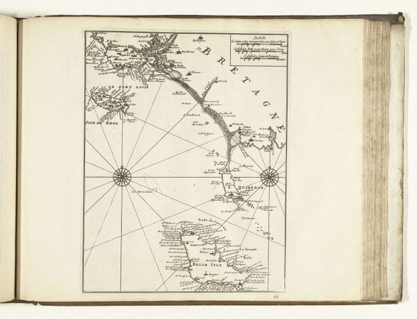
Dimensions: height 227 mm, width 333 mm
Copyright: Rijks Museum: Open Domain
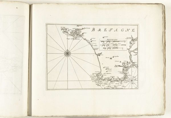
Editor: Here we have an engraving from 1726, *Kaart van de westkust van Bretagne*, meaning *Map of the west coast of Brittany*. It's by an anonymous artist and held at the Rijksmuseum. The delicate lines detailing the coastline are impressive. It makes me think about how people must have viewed their world back then. What stands out to you in this piece? Curator: For me, it’s how maps, seemingly objective, were imbued with cultural weight. Take, for example, the elaborate compass rose, not just functional, but a symbol of orientation – culturally, psychologically, and of course, geographically. Consider too, the density of place-names hugging the coast – they aren't simply labels, but a palimpsest of linguistic and historical layers accumulated over centuries, cultural memory etched onto the land. Editor: Palimpsest? Like something written over and over? Curator: Exactly! Each name echoes a past, a culture, a struggle for identity. Now, think about what isn’t shown: the lives, the social fabric that clings to that coast. It is rendered absent. Doesn’t that absence speak volumes? Editor: It does. The map presents this clean, almost sterile image of Brittany, while so much human experience is invisible. Almost like the map is the symbolic representation of an administrative viewpoint. Curator: Precisely. The act of mapping is an act of claiming, controlling, and of shaping a narrative. The baroque style hints at an inherent ambition – an emotional exuberance that amplifies that impulse. Do you notice anything else about how this coastline is visually described? Editor: I guess the dramatic contrast between land and sea is saying something. It evokes adventure. Looking at it now, that tension adds so much to its meaning. Curator: Indeed. The history, ambition, artistry... it’s far more than just lines on paper, isn't it? Editor: I'll never look at an old map the same way again!
Comments
No comments
Be the first to comment and join the conversation on the ultimate creative platform.
More like this