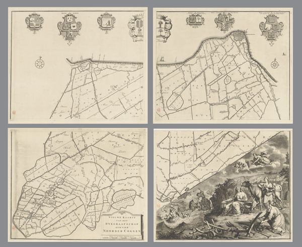
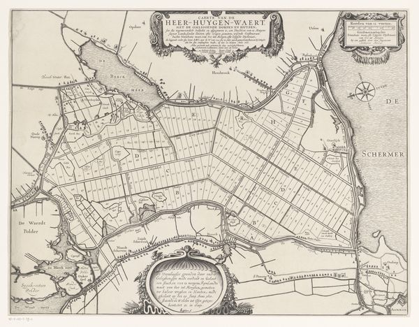
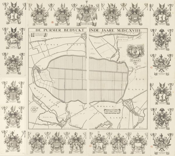
Kaart van het dijkgraafschap van de Vier Noorder Koggen (deel rechtsboven) 1731
0:00
0:00
hendrikdeleth
Rijksmuseum
drawing, print, ink, engraving
#
drawing
#
comic strip sketch
#
baroque
#
mechanical pen drawing
# print
#
pen illustration
#
pen sketch
#
old engraving style
#
landscape
#
personal sketchbook
#
ink
#
pen-ink sketch
#
pen work
#
sketchbook drawing
#
storyboard and sketchbook work
#
engraving
Dimensions: height 481 mm, width 590 mm
Copyright: Rijks Museum: Open Domain
This is Hendrik de Leth’s map of the Four Northern Koggen district, made in the 18th century. Dominating the upper portion, we find heraldic symbols, emblems of authority and identity. Note the repeated appearance of trees. These are potent symbols, and here they signify not just the natural landscape, but also notions of growth, stability, and rootedness. Consider how the tree motif has appeared throughout history, from the Tree of Life in ancient mythologies to family trees denoting lineage. The image resonates with a deep-seated human desire for order and understanding. This is something we see repeated again and again in different cultures and times. The map presents a landscape meticulously divided, a testament to human attempts to control and organize the world. Yet, beneath this veneer of order lies the subconscious recognition of nature’s untamable forces. These emblems, while appearing static, contain within them a long history. They embody the cyclical nature of symbols—how they resurface, evolve, and are continuously reinterpreted across generations.
Comments
No comments
Be the first to comment and join the conversation on the ultimate creative platform.
More like this