print, engraving
#
dutch-golden-age
# print
#
landscape
#
geometric
#
decorative-art
#
engraving
Dimensions: height 1036 mm, width 1108 mm
Copyright: Rijks Museum: Open Domain
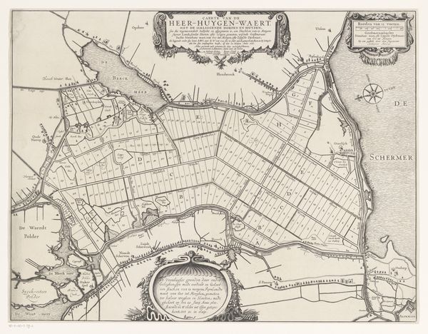
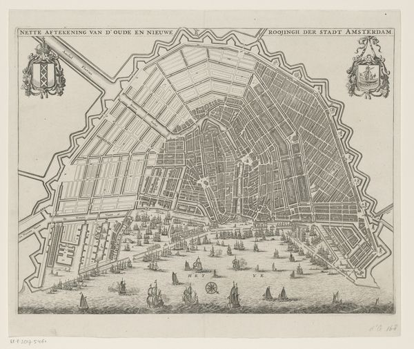
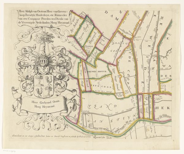
Curator: This print, "Kaart van de Purmer met wapenrand, bestaande uit zes delen," from 1683, depicts a map of the Purmer region in the Netherlands. Editor: My initial impression is that this work feels quite formal, almost bureaucratic. It is visually dominated by a rigid, gridded structure imposed on the land, juxtaposed with these elaborate, almost baroque-style family crests. Curator: Absolutely. The core of the piece shows an ordered landscape, meticulously rendered to maximize arable land through the polder system. The means of creating it—engraving—allowed for incredibly precise and replicable imagery. We see how this new way of materializing geography transformed space and labour in the 17th century. Editor: Which is then echoed by the symbolic weight of these bordering coats of arms. To me, they seem like very visual cues about power, property, and social hierarchy. How might the social elite of the Dutch Golden Age have benefited directly from the manipulation and control of their land? Curator: Precisely! The technical act of land reclamation, the engraving technique employed, and the consumption of such a visual record intersect. Each tells a story about resource exploitation, the transformation of our environment, and, importantly, who controls the methods of representation and distribution of these resources. Editor: It's this relationship between knowledge and power that fascinates me. A piece like this reminds us that mapping is never a neutral act. This artwork isn't just showing the landscape but making assertions about whose vision matters, whose interests are served, and how it might exclude marginalized communities from benefiting. Curator: Yes. This cartographic assertion relies directly on the work of anonymous labourers, the engravers, and even those responsible for maintaining the dykes—unacknowledged in these aristocratic displays. These workers who directly altered and allowed for the extraction of natural capital through draining and cultivating what was once a lake! Editor: Examining "Kaart van de Purmer" invites critical questions about our present relationships between environment and social power. We must acknowledge not just the beauty or artistry in this print, but consider whose stories have been erased to make its neat and ordered reality possible. Curator: Indeed, looking at this print compels me to think about the lasting social impact inherent in the physical alterations and in this moment of artistic production. It really goes beyond just art, it really helps us think about labour, capitalism, and class!
Comments
No comments
Be the first to comment and join the conversation on the ultimate creative platform.
More like this