About this artwork
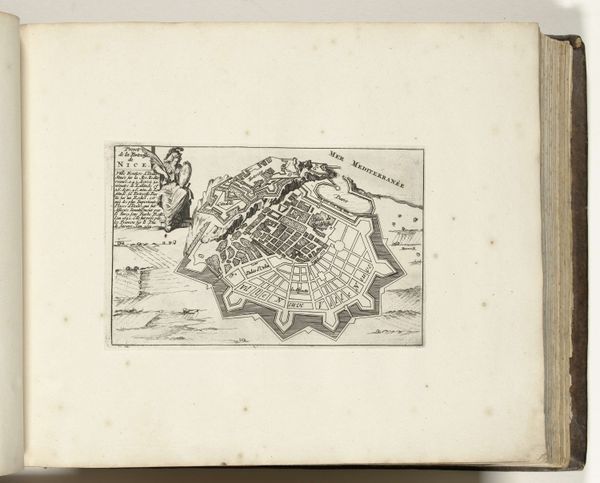
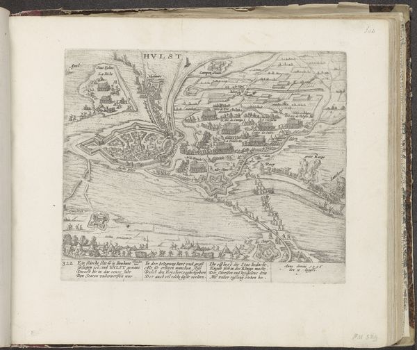
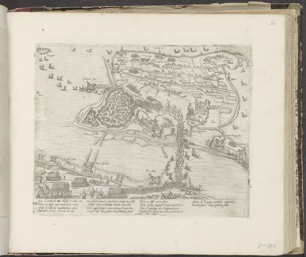
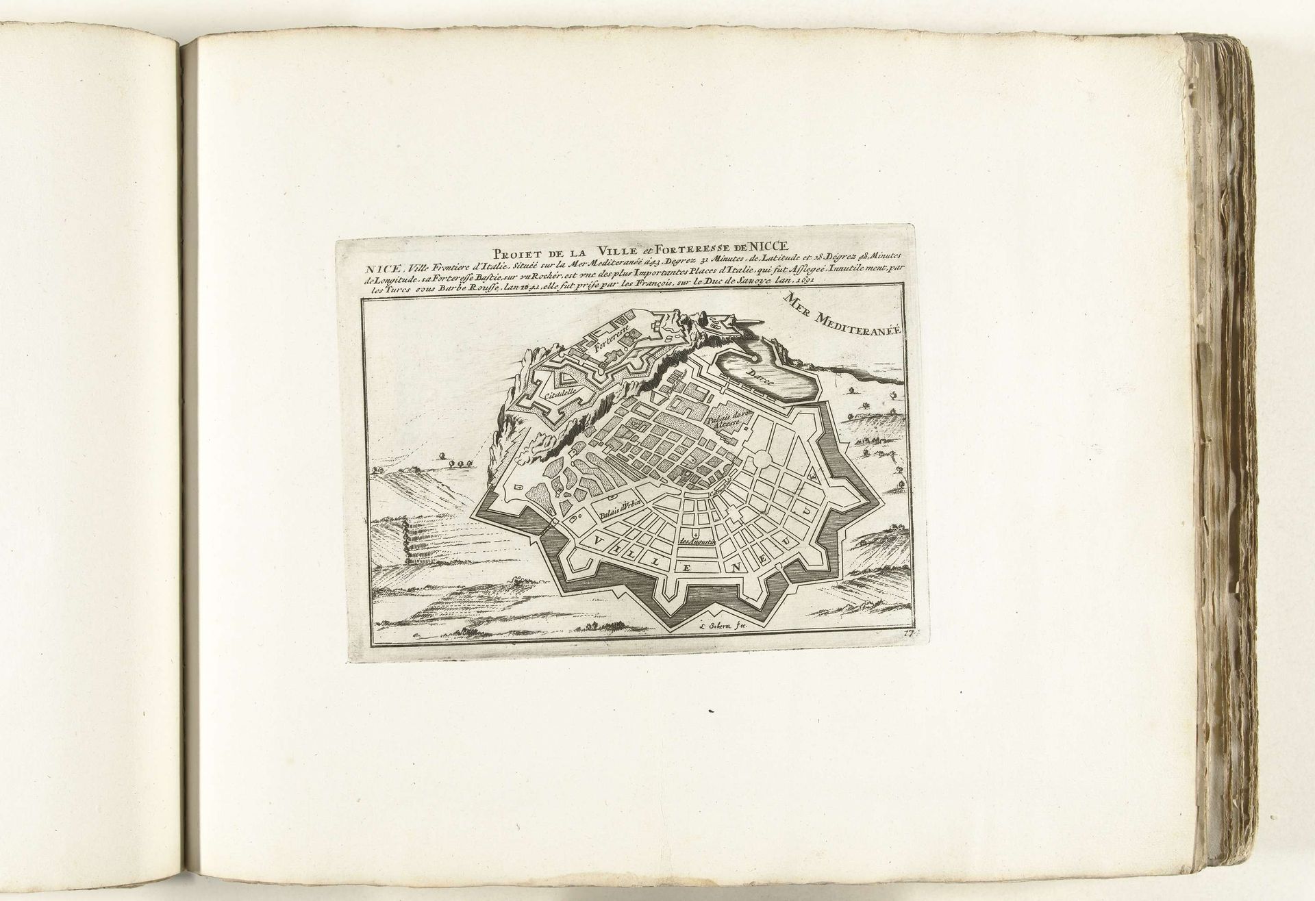
Laurens Scherm made this detailed map of Nice around 1702, using ink on paper. The fine lines and intricate details were likely achieved through etching or engraving, processes that demand precision and patience. The material itself, paper, was becoming increasingly available at this time. The rise of printmaking had obvious ties to burgeoning trade networks and the circulation of knowledge. Look closely, and you'll notice the star-shaped fortifications, rendered with meticulous accuracy. Each line and contour speaks to the strategic importance of Nice as a port city. Consider the labor involved in creating such a map: the surveying, the drafting, the skilled hand of the printmaker. This wasn't just an artistic endeavor; it was a document of power, reflecting the ambitions of rulers and the realities of urban life. By attending to the materials and processes behind this map, we gain insight into the economic and social forces that shaped its creation, transcending the boundaries of both art and cartography.
Artwork details
- Medium
- graphic-art, print, engraving, architecture
- Dimensions
- height 163 mm, width 223 mm
- Location
- Rijksmuseum
- Copyright
- Rijks Museum: Open Domain
Tags
Comments
Share your thoughts
About this artwork
Laurens Scherm made this detailed map of Nice around 1702, using ink on paper. The fine lines and intricate details were likely achieved through etching or engraving, processes that demand precision and patience. The material itself, paper, was becoming increasingly available at this time. The rise of printmaking had obvious ties to burgeoning trade networks and the circulation of knowledge. Look closely, and you'll notice the star-shaped fortifications, rendered with meticulous accuracy. Each line and contour speaks to the strategic importance of Nice as a port city. Consider the labor involved in creating such a map: the surveying, the drafting, the skilled hand of the printmaker. This wasn't just an artistic endeavor; it was a document of power, reflecting the ambitions of rulers and the realities of urban life. By attending to the materials and processes behind this map, we gain insight into the economic and social forces that shaped its creation, transcending the boundaries of both art and cartography.
Comments
Share your thoughts