drawing, print, paper, ink
#
drawing
#
baroque
# print
#
landscape
#
paper
#
ink
#
geometric
#
cityscape
Dimensions: height 221 mm, width 286 mm
Copyright: Rijks Museum: Open Domain
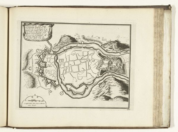
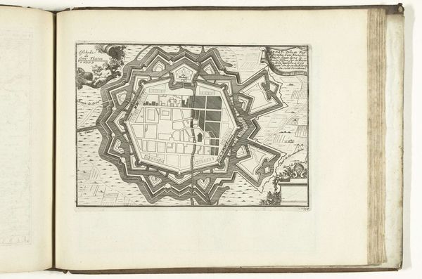
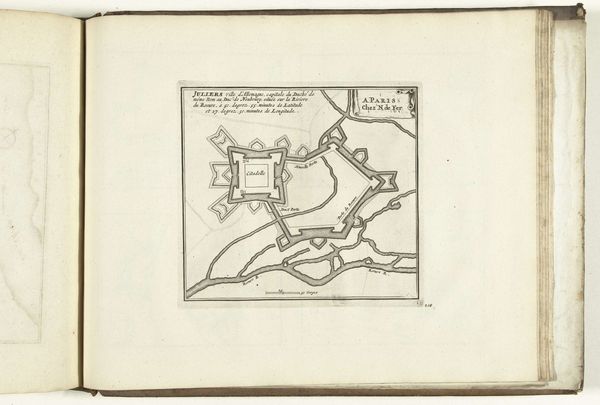
This is an anonymous plan of Longwy made in 1726, showcasing the town's fortress, a polygon of defense. The star-shaped bastion, with its points jutting outwards, is not merely an architectural choice. It is a symbol, echoing the sun's rays, imbued with protective power. We see this star motif across time, from ancient Mesopotamian emblems to Renaissance heraldry. This image resonates with the deep-seated human need for security, the subconscious desire for a protected space. Consider the mandala, with its geometric precision and spiritual significance, designed to offer a center of contemplation. The fortress plan similarly provides a sense of order and control, reflecting the human need to structure and secure our world. This primal defense mechanism, encoded into our collective memory, surfaces here, rendered in ink. The town as sanctuary.
Comments
No comments
Be the first to comment and join the conversation on the ultimate creative platform.
More like this