drawing, print, paper, ink, engraving
drawing
baroque
landscape
paper
ink
cityscape
engraving
Dimensions: height 247 mm, width 282 mm
Copyright: Rijks Museum: Open Domain
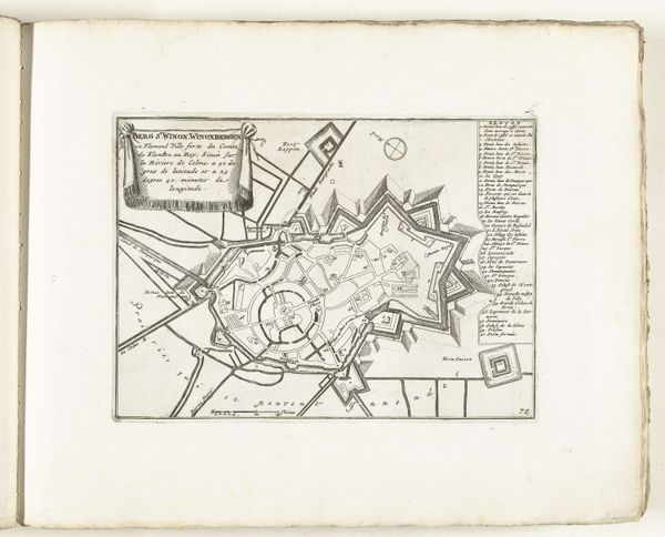
This is Abraham Allard's "Plattegrond van Venlo," made sometime between 1701 and 1713. The print presents a bird's-eye view of Venlo, the city’s layout defined by precise lines and geometric forms. The most striking feature is the town's fortification, shaped like a polygon, demonstrating an interplay between organic form and imposed structure. The map is more than a simple representation of space; it is a symbol of power and control, communicating how urban spaces can be structured and viewed. The composition emphasizes the relationship between the town and the surrounding waterways, with the river visually bisecting the town, adding depth and perspective. The use of line becomes a dominant semiotic element, delineating boundaries and suggesting order. In viewing this map, we are invited to consider how cartography not only reflects geographical reality but also conveys cultural values and power structures. The map thus becomes a discourse on space, power, and perception.
Comments
No comments
Be the first to comment and join the conversation on the ultimate creative platform.