drawing, print, ink, pen, engraving, architecture
#
drawing
#
aged paper
#
baroque
# print
#
pen sketch
#
sketch book
#
hand drawn type
#
personal sketchbook
#
ink
#
pen-ink sketch
#
ink colored
#
line
#
pen work
#
sketchbook drawing
#
pen
#
cityscape
#
sketchbook art
#
engraving
#
architecture
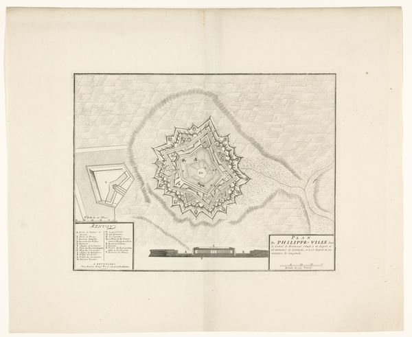
Dimensions: height 309 mm, width 405 mm
Copyright: Rijks Museum: Open Domain
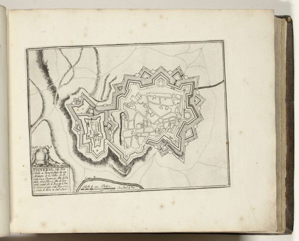
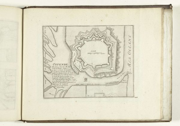
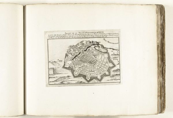
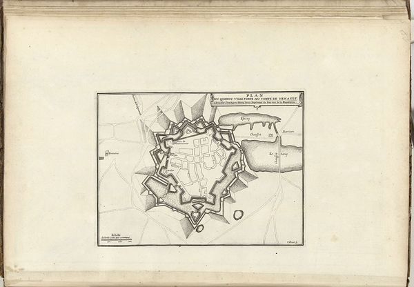
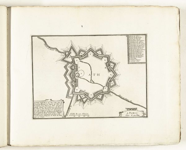
Jacobus Harrewijn etched this plan of Philippeville in 1710, capturing the city's fortifications with stark precision. What strikes the eye is the star-shaped fort, a symbol of military might that echoes through history. We see this star motif reappearing across different cultures, a silent carrier of the will to power. Think of the Renaissance star forts, or even the symbolic stars adorning royal garments. This shape transcends mere geometry; it embodies a collective desire for protection, a visual echo of our deepest fears and aspirations. It’s a recurring dream, if you will, etched into the very fabric of civilization. The angles, the points, they all speak to our primal need for safety, for dominance. Note how the fort rises from the landscape, a psychological assertion, commanding not only the land but also the viewer’s gaze. Its stark geometry conveys strength, yet also hints at the isolation and paranoia inherent in such power. This plan is not just a map, but a window into the soul of an age, forever caught between ambition and anxiety.
Comments
No comments
Be the first to comment and join the conversation on the ultimate creative platform.
More like this