drawing, print, ink, engraving
#
drawing
# print
#
old engraving style
#
landscape
#
ink line art
#
ink
#
geometric
#
line
#
northern-renaissance
#
early-renaissance
#
engraving
Dimensions: height 150 mm, width 197 mm
Copyright: Rijks Museum: Open Domain
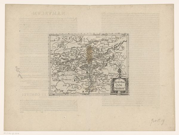
This is an anonymous map of Gelderland. It's hard to put a firm date on it but it was likely made sometime in the 17th century, probably as an engraving. Maps like this one have always been more than simple records of geographical features. They're tied to issues of land ownership, political control, and military strategy. The very act of mapping is an exercise of power. This map might have been commissioned by a wealthy landowner, a civic authority, or even a military planner, each with their own agenda. Look at the elaborate cartouche. The inclusion of the coat-of-arms shows us that the image creates meaning through cultural references. The map seems to be saying something about regional identity and the way Gelderland relates to the world around it. As historians, our task is to unpack these meanings using documentary sources. We can learn more about who made this map and why, what it tells us about the society that produced it, and how that society saw itself in relation to the wider world.
Comments
No comments
Be the first to comment and join the conversation on the ultimate creative platform.
More like this