graphic-art, print, engraving
#
graphic-art
#
dutch-golden-age
# print
#
landscape
#
engraving
Dimensions: height 224 mm, width 300 mm
Copyright: Rijks Museum: Open Domain
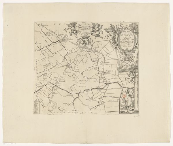
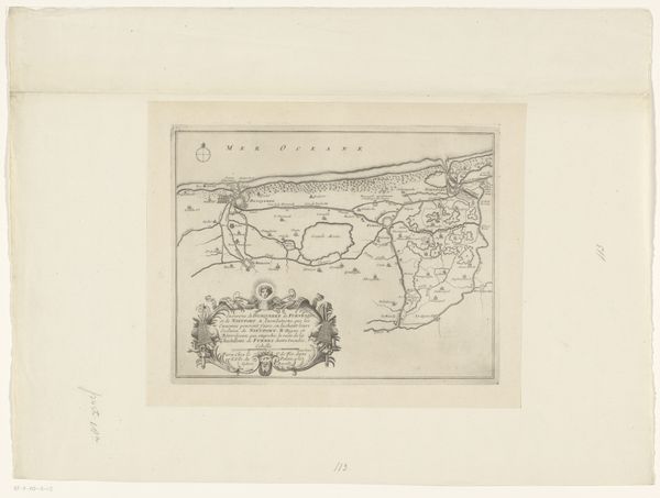
This map of Kollumerland en Nieuwkruisland, was made by Jacob van Meurs in the 17th Century, using engraving on paper. The process of engraving involves cutting lines into a metal plate, inking the plate, and then using a press to transfer the ink to paper. The fine lines and detailed rendering of this map speak to Van Meurs's skill as an engraver, as does the careful printing, resulting in a clean image. But the choice of printmaking also speaks to a wider social context. In the 17th century, the Netherlands was a hub of cartography and printing, reflecting the country's global trade networks and expanding knowledge of the world. Maps like these were not just geographical tools, but also symbols of power and commerce. The very act of mapping territory implies a desire to control and administer it. It’s important to remember that what we see in a work like this is not simply a neutral record, but an active statement. Ultimately, the value of this piece lies in understanding it as a product of labor, technology, and societal ambition, a tangible expression of the age.
Comments
No comments
Be the first to comment and join the conversation on the ultimate creative platform.
More like this