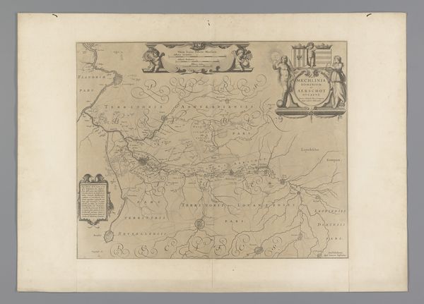
print, engraving
#
baroque
# print
#
landscape
#
ink drawing experimentation
#
engraving
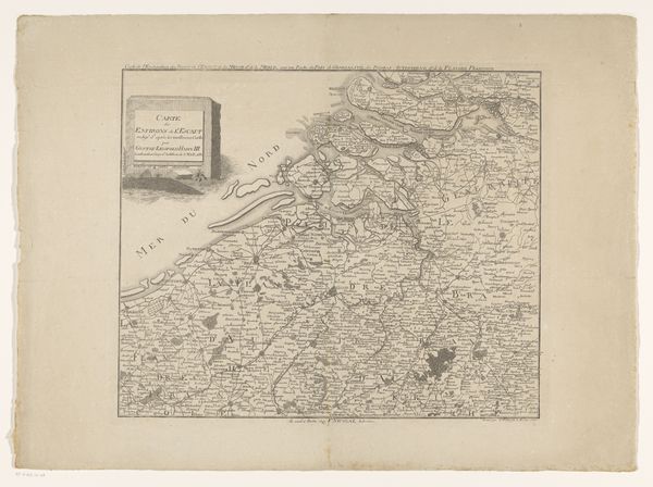
Dimensions: height 227 mm, width 288 mm
Copyright: Rijks Museum: Open Domain
Editor: We're looking at "Kaart van de Vlaamse kust tussen Duinkerke en Nieuwpoort," a Baroque engraving dating from around 1690 to 1696, currently housed at the Rijksmuseum. I’m struck by how delicate the lines are, especially given it's a map, something so technical. What jumps out at you when you see this, especially given its historical context? Curator: Well, I find it charming that something functional can also be quite beautiful. I love thinking about how maps from this period are a mixture of emerging scientific precision with, say, a healthy dose of artistic license. Imagine someone charting unknown territories, literally drawing the world as they understand it—not necessarily as it *is*. It becomes a projection of power, doesn’t it? Editor: That's interesting. Power projected how? Curator: Think about it: the act of mapping is an act of claiming. The map becomes a tool for visualizing possession, influence, for those who commission and then utilize it. This coast was contested ground. Whose perspective does this map serve? Are those embellishments around the title purely decorative, or do they hint at allegiance? I bet, like all great maps, this one tells many silent stories, each line humming with unspoken agendas. Editor: That gives me a new appreciation for what's usually relegated to the "historical documents" section. So, what have you learned? Curator: Maps, even old ones, they aren't neutral records. They’re a lens, offering glimpses into not only physical spaces but the minds of those who shaped them, agendas and all! Editor: I definitely see that now. Thanks for opening my eyes!
Comments
No comments
Be the first to comment and join the conversation on the ultimate creative platform.
More like this