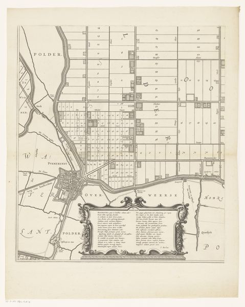
Kaart van de Schermer na voltooiing van de bedijking en verloting van de kavels, 1635 before 1640
0:00
0:00
print, paper, ink, engraving
#
dutch-golden-age
# print
#
old engraving style
#
landscape
#
paper
#
ink
#
geometric
#
cityscape
#
engraving
Dimensions: height 175 mm, width 239 mm
Copyright: Rijks Museum: Open Domain
This is Salomon Rogiers' "Kaart van de Schermer na voltooiing van de bedijking en verloting van de kavels", created in 1635. The map presents a bird's-eye view of a meticulously planned landscape using precise lines and structured organization of space, conveying both geographical data and an idealized vision of land management. The overall composition is dominated by a grid-like network of lines and geometric shapes, establishing a clear visual language through which the territory is represented and understood. This emphasis on order and rationality speaks to the broader cultural and philosophical shifts during the 17th century, where cartography became intertwined with political power, economic planning, and scientific observation. The map's intricate organization reflects an attempt to impose structure onto nature, echoing the broader humanistic project of mastering and codifying the world through rational means. The map transcends its practical function, embodying a conceptual framework for understanding space, ownership, and the relationship between humanity and the environment.
Comments
No comments
Be the first to comment and join the conversation on the ultimate creative platform.
More like this