About this artwork
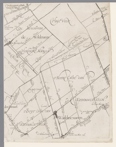
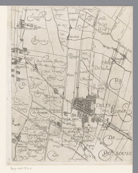
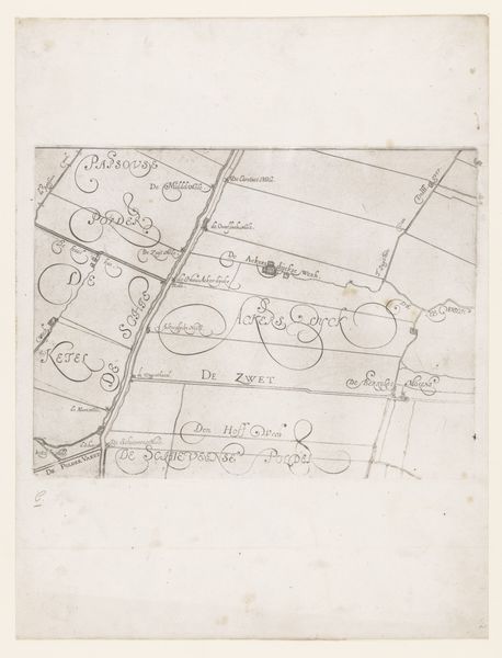
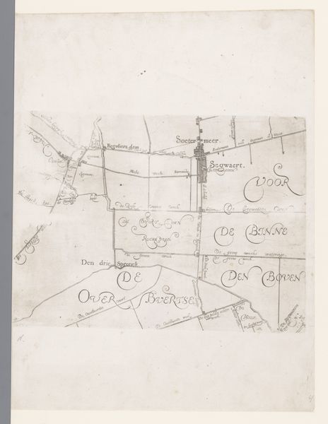
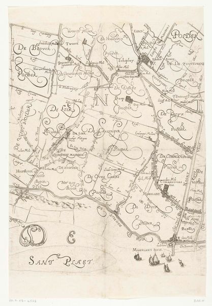
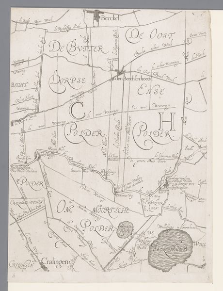
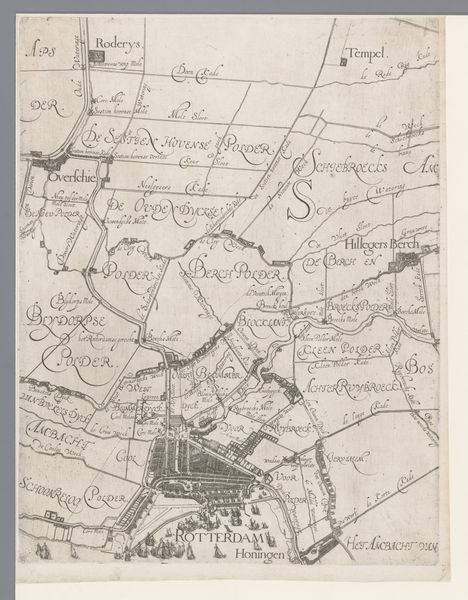
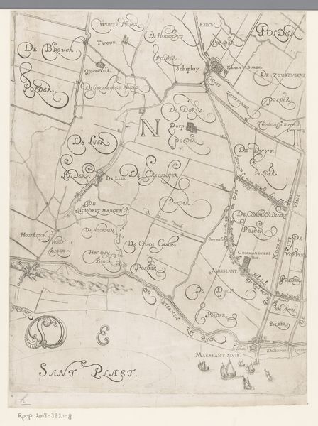
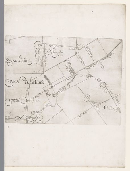
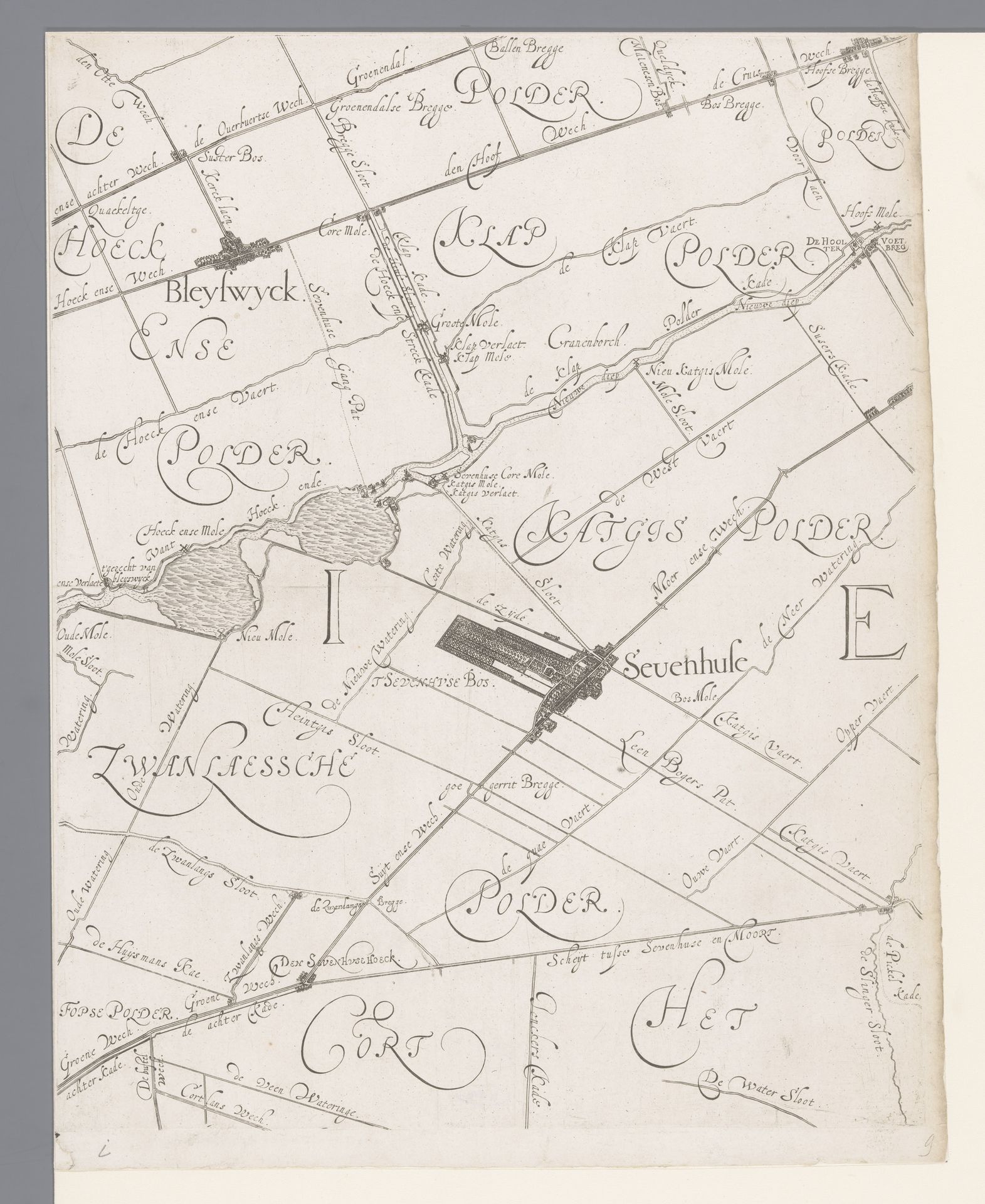
Curator: This delicately rendered map offers a fascinating look at the Hoogheemraadschap of Schieland, including Zevenhuizen and Bleiswijk, dating back to the period of 1611 to 1635. The mapmaker was Floris Balthasarsz van Berckenrode. Editor: The first thing that strikes me is its sense of control, this desire to chart and organize the landscape. There is an underlying assertion of human power. Curator: Absolutely. Notice the meticulous lines and the clear demarcations, carefully laid out using ink on paper. The artist's precision speaks volumes about the values placed on order and clarity. This work functions primarily as a geometrical arrangement with each calculated line precisely meeting at intersection points and angles. Editor: Yet, the elegance of the calligraphy softens the rigid geometry, don't you think? It's as if the mapmaker wanted to make this act of control appear beautiful, to mask power with aesthetic charm. Think about it, the land, especially "polders," represents an intense negotiation with nature. Who benefits, who gets access to that land, how is it distributed? These lines represent real material implications. Curator: I see your point. There is that subtle tension between the imposed structure and the fluidity suggested by the handwritten labels. The overall tonality of the work does, I believe, create a cohesive visual field of expert articulation. Editor: I'm wondering how access to this information shaped societal structures at the time. Was this a tool for landowners, or for broader civic planning? Were decisions made here based on equity, or was there an undercurrent of privilege determining land allocation and distribution? This wasn't merely about geography, but governance. Curator: Well, in my opinion, considering the historical context allows for a richer experience of its formal arrangement. The lines aren’t simply delineations; they delineate power structures as much as landscapes. Editor: Right. Looking at it now, the elegance of the piece also becomes a testament to the intense social negotiation embedded within it. A potent intersection between representation, authority, and control of environmental resources is highlighted. Curator: Ultimately, examining the artistic presentation alongside the historical conditions lets us extract deeper value from the Dutch map. Editor: Exactly! By bringing together aesthetics and the historical frameworks through an intersectional lens, we are able to extract broader critical possibilities of meaning.
Kaart van het Hoogheemraadschap van Schieland, met Zevenhuizen en Bleiswijk
1611 - 1635
Floris Balthasarsz van Berckenrode
1562 - 1616Location
RijksmuseumArtwork details
- Medium
- drawing, print, intaglio, paper, ink
- Dimensions
- height 383 mm, width 305 mm
- Location
- Rijksmuseum
- Copyright
- Rijks Museum: Open Domain
Tags
Comments
Share your thoughts
About this artwork
Curator: This delicately rendered map offers a fascinating look at the Hoogheemraadschap of Schieland, including Zevenhuizen and Bleiswijk, dating back to the period of 1611 to 1635. The mapmaker was Floris Balthasarsz van Berckenrode. Editor: The first thing that strikes me is its sense of control, this desire to chart and organize the landscape. There is an underlying assertion of human power. Curator: Absolutely. Notice the meticulous lines and the clear demarcations, carefully laid out using ink on paper. The artist's precision speaks volumes about the values placed on order and clarity. This work functions primarily as a geometrical arrangement with each calculated line precisely meeting at intersection points and angles. Editor: Yet, the elegance of the calligraphy softens the rigid geometry, don't you think? It's as if the mapmaker wanted to make this act of control appear beautiful, to mask power with aesthetic charm. Think about it, the land, especially "polders," represents an intense negotiation with nature. Who benefits, who gets access to that land, how is it distributed? These lines represent real material implications. Curator: I see your point. There is that subtle tension between the imposed structure and the fluidity suggested by the handwritten labels. The overall tonality of the work does, I believe, create a cohesive visual field of expert articulation. Editor: I'm wondering how access to this information shaped societal structures at the time. Was this a tool for landowners, or for broader civic planning? Were decisions made here based on equity, or was there an undercurrent of privilege determining land allocation and distribution? This wasn't merely about geography, but governance. Curator: Well, in my opinion, considering the historical context allows for a richer experience of its formal arrangement. The lines aren’t simply delineations; they delineate power structures as much as landscapes. Editor: Right. Looking at it now, the elegance of the piece also becomes a testament to the intense social negotiation embedded within it. A potent intersection between representation, authority, and control of environmental resources is highlighted. Curator: Ultimately, examining the artistic presentation alongside the historical conditions lets us extract deeper value from the Dutch map. Editor: Exactly! By bringing together aesthetics and the historical frameworks through an intersectional lens, we are able to extract broader critical possibilities of meaning.
Comments
Share your thoughts