drawing, print, engraving
drawing
baroque
cityscape
engraving
Dimensions: height 482 mm, width 602 mm
Copyright: Rijks Museum: Open Domain
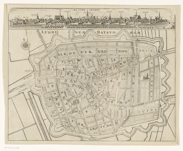
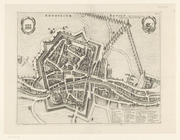
Curator: This exquisitely detailed map section, entitled "Plattegrond van Leiden (deel linksonder)," originates from after 1675, giving us a fascinating birds-eye view of the city. Currently held at the Rijksmuseum, it showcases Leiden through the precise lines of an engraving. Editor: Immediately, I'm struck by the sheer intricacy. The lines are so delicate, creating a visually compelling contrast between open spaces and densely packed structures. It has a remarkably clean and balanced composition overall. Curator: Precisely. Maps of this nature served not only as navigational tools but also as potent symbols of civic pride and control. Notice the strategic rendering of fortifications and key landmarks, which reinforce Leiden's status during the Dutch Golden Age. Editor: Yes, the geometric precision in representing the urban layout is very satisfying. The use of perspective and the clarity of line work create an appealing visual order. There's even a subtle but clear hierarchy of visual elements as your eyes are drawn from major routes down to even the smallest individual streets and properties. Curator: Beyond aesthetics, each street and building held profound social and economic significance. Canals facilitated trade, while the layout of residential areas reflected the city’s complex social hierarchies. Imagine how this map shaped urban planning and perceptions of space at the time. Editor: It’s also compelling to examine it now through modern eyes. How a city, with all its organic human mess, can be compressed down into such clearly defined graphical elements and patterns, rendered by repetitive line. You start to think about data visualization, semiotics, how humans encode our messy reality into information… Curator: Indeed, maps can act like a lens, framing space through social and political intention. Thank you for that observation, the artwork offers many paths of inquiry for the modern observer. Editor: It has been a pleasure to focus my thoughts around it and come away seeing my environment in new terms.
Comments
No comments
Be the first to comment and join the conversation on the ultimate creative platform.