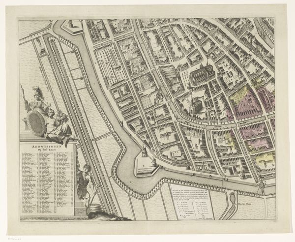
print, engraving
dutch-golden-age
old engraving style
cityscape
engraving
Dimensions: height 290 mm, width 364 mm
Copyright: Rijks Museum: Open Domain
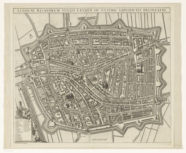
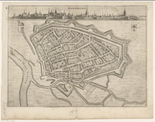
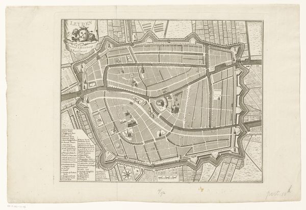
Curator: Here we have an intriguing print, titled "Plattegrond van Leiden met stadsgezicht," which roughly translates to "Map of Leiden with City View." It was created sometime between 1614 and 1726, so placing it firmly within the Dutch Golden Age. The creator remains anonymous, which presents its own set of interpretative questions, doesn't it? Editor: Absolutely! It's funny, the first thing that jumps out is how geometric it all is. It feels so deliberate, almost like an abstract pattern before you recognize it's a real place. And then there's this kind of nostalgic longing. Like peering into a distant memory. Curator: Nostalgia is certainly part of it. Consider the context. The Dutch Golden Age was a period of immense economic and cultural expansion for the Netherlands. Mapping the city was, in many ways, mapping power, claiming territory both physically and intellectually. The grid-like structure you noticed reflects not just the urban planning of the time but a certain impulse to control and categorize the world. Editor: You're right, there is definitely something authoritative in this map, like saying, "We've figured this out." It reminds me of when I was a child creating my own cities in the sandbox, claiming them as my territory. Look at those little ships! What would life be like on board one of them in Leiden at the time? And all that text in Latin... I guess everyone understood it? Curator: Latin was the lingua franca of scholarship. So the inclusion serves to legitimize the map, positioning it within a learned tradition. But more broadly, urban mapping in the early modern period intersects with colonial expansion. How does the representation of space impact social relationships? Who gets included? Who gets excluded? Editor: So the beautiful cartography becomes part of something complex and less attractive, a type of violence of classification? But at the end, I come back to how cool the map looks—the details, the light and dark and crosshatching, they pull me into imagining all those lost and nameless stories that must be rooted in the houses represented there. Curator: Indeed. And perhaps that tension between the aesthetic and the political is what makes it so compelling to revisit such maps now. It's a beautiful representation of a time with deep social complexities. Editor: I agree. I like that, even after all this time and analysis, it can still spark such intimate imaginings about ordinary lives.
Comments
No comments
Be the first to comment and join the conversation on the ultimate creative platform.